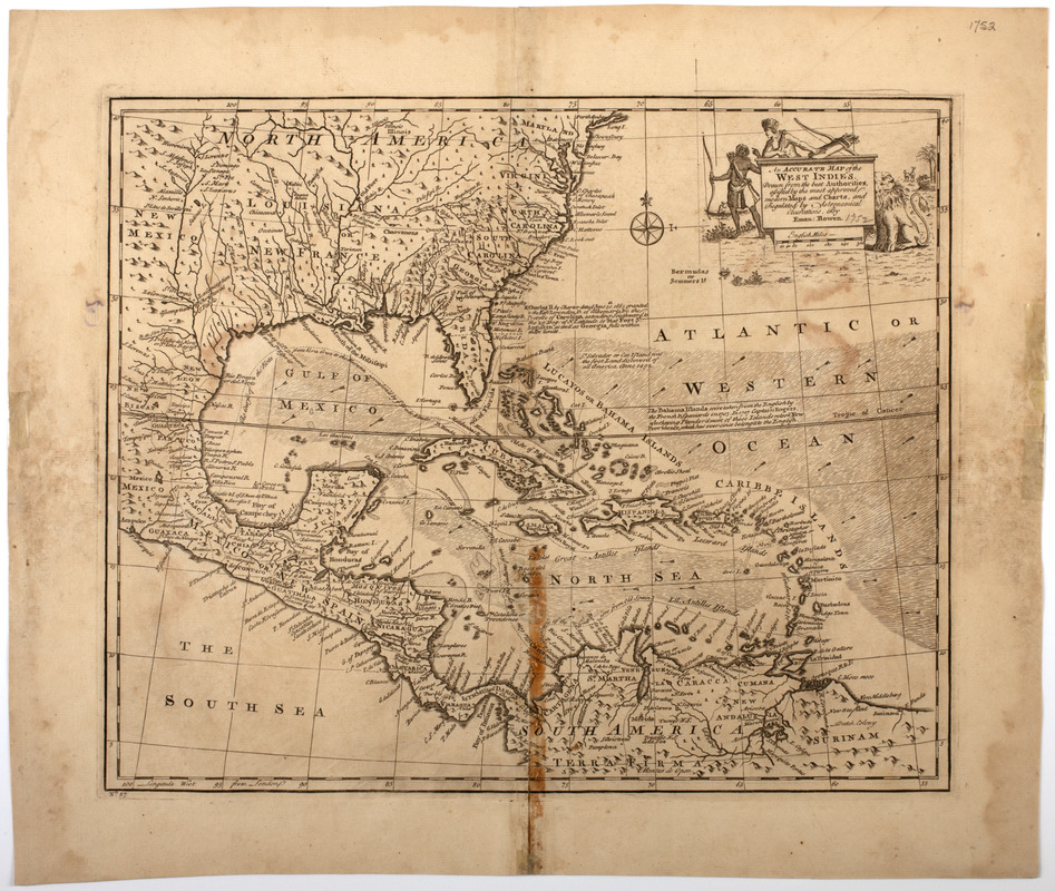
An accurate map of the West Indies
This map is also available in American Revolutionary Geographies Online (ARGO), a collections portal especially built for material relating to the American Revolutionary War Era. Visit ARGO to learn more about this item and explore the historical geography of North America in the late eighteenth century.
Item Information
- Title:
- An accurate map of the West Indies
- Description:
-
Subject: Map of the West Indies, including the southeastern United States, part of Mexico, and the northern part of South America. Cartouche shows two Native American men holding bows and quivers. A lion is at right.
- Creator:
- Bowen, Emanuel, -1767
- Name on Item:
-
Drawn from the best authorities, assisted by the most approved modern maps and charts, and regulated by astronomical observations, by Eman. Bowen.
- Date:
-
[1752]
- Format:
-
Maps/Atlases
- Location:
- American Antiquarian Society
- Collection (local):
-
American Antiquarian Society Collection
- Subjects:
-
Indians of North America--Pictorial works
West Indies--Maps
- Places:
-
West Indies
- Extent:
- 1 map : engraving ; 35 x 42 cm., on sheet 44 x 52 cm.
- Terms of Use:
-
Public Domain/No known restrictions on use. Contact host institution to download image.
Contact host institution for more information.
- Publisher:
-
London :
[s.n.]
- Scale:
-
Scale [ca. 1:11,400,000]
- Language:
-
English
- Catalog Record:
-
http://catalog.mwa.org/vwebv/holdingsInfo?bibId=482681
- Notes:
-
Relief shown pictorially.
From Bowen, E. A complete atlas or distinct view of the known world, London, 1752.
- Notes (date):
-
This date is inferred.


