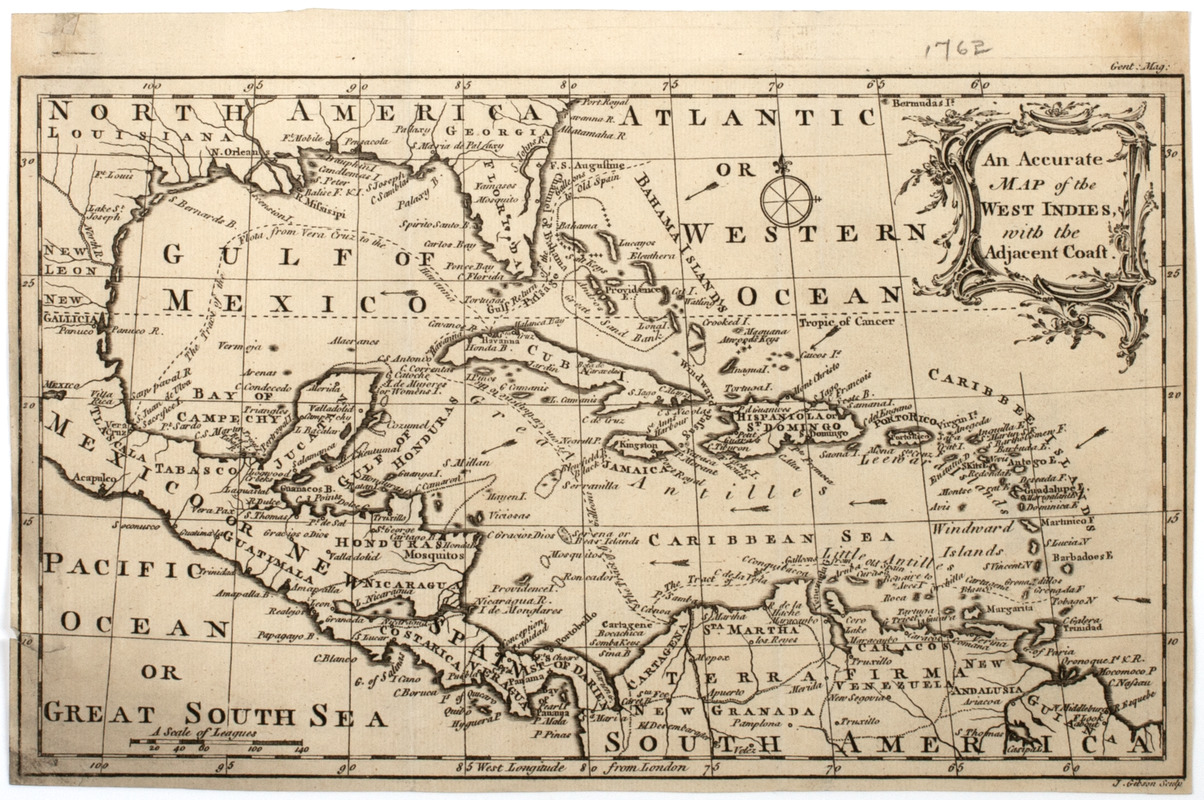
An Accurate map of the West Indies, with the adjacent coast
This map is also available in American Revolutionary Geographies Online (ARGO), a collections portal especially built for material relating to the American Revolutionary War Era. Visit ARGO to learn more about this item and explore the historical geography of North America in the late eighteenth century.
Item Information
- Title:
- An Accurate map of the West Indies, with the adjacent coast
- Title (uniform):
-
Gentleman's magazine (London, England)
- Description:
-
Subject: Map of the West Indies and Caribbean including parts of the southeastern United States, Mexico and the northern part of South America.
- Former owner:
- Walker, John
- Engraver:
- Gibson, J. (John), active 1750-1792
- Name on Item:
-
J. Gibson sculp.
- Date:
-
[1762]
- Format:
-
Maps/Atlases
- Location:
- American Antiquarian Society
- Collection (local):
-
American Antiquarian Society Collection
- Subjects:
-
West Indies--Maps
Caribbean Area--Maps
- Places:
-
West Indies
Caribbean Sea
- Extent:
- 1 map : engraving ; 18 x 30 cm., on sheet 20 x 30 cm.
- Terms of Use:
-
Public Domain/No known restrictions on use. Contact host institution to download image.
Contact host institution for more information.
- Publisher:
-
London :
[s.n.]
- Scale:
-
Scale [ca. 1:20,000,000]
- Language:
-
English
- Catalog Record:
-
http://catalog.mwa.org/vwebv/holdingsInfo?bibId=483146
- Notes:
-
Relief shown pictorially.
"Gent. mag."
From Gentleman's magazine, London, February, 1762.
- Notes (date):
-
This date is inferred.


