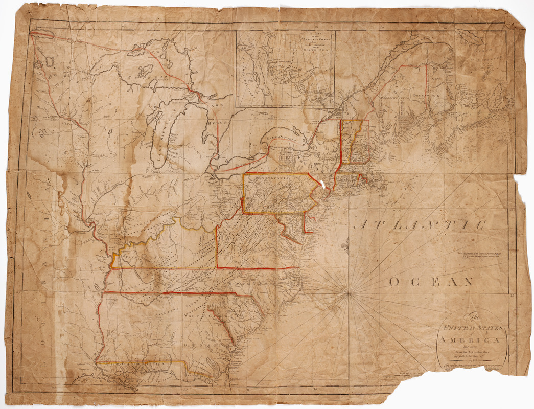
The United States of America : laid down from the best authorities agreeable to the peace of 1783. : This map and chart is neither a plain, Mercators, nor globular projection
This map is also available in American Revolutionary Geographies Online (ARGO), a collections portal especially built for material relating to the American Revolutionary War Era. Visit ARGO to learn more about this item and explore the historical geography of North America in the late eighteenth century.
Item Information
- Title:
- The United States of America : laid down from the best authorities agreeable to the peace of 1783. : This map and chart is neither a plain, Mercators, nor globular projection
- Description:
-
Subject: Map of the United States stretching to the Louisiana territory. Shows locations of Native American lands.
- Creator:
- Carleton, Osgood, 1742-1816
- Publisher:
- Norman, John, 1748?-1817
- Name on Item:
-
Osgood Carleton, teacher of mathematics.
- Date:
-
[1791]
- Format:
-
Maps/Atlases
- Location:
- American Antiquarian Society
- Collection (local):
-
American Antiquarian Society Collection
- Subjects:
-
United States--Maps
- Places:
-
- Extent:
- 1 map on 5 sheets : engraving, hand colored ; 82 x 112 cm., on sheets 52 x 41 cm. or smaller
- Terms of Use:
-
Public Domain/No known restrictions on use. Contact host institution to download image.
Contact host institution for more information.
- Publisher:
-
Boston :
Published & sold by J. Norman no. 75 Newbury Street.
- Scale:
-
Scale [ca. 1:2,850,000]
- Language:
-
English
- Catalog Record:
-
http://catalog.mwa.org/vwebv/holdingsInfo?bibId=485070
- Notes:
-
Relief shown pictorially. Depths shown by soundings.
Advertised in the Boston gazette, March 21, 1791.
- Notes (date):
-
This date is inferred.


