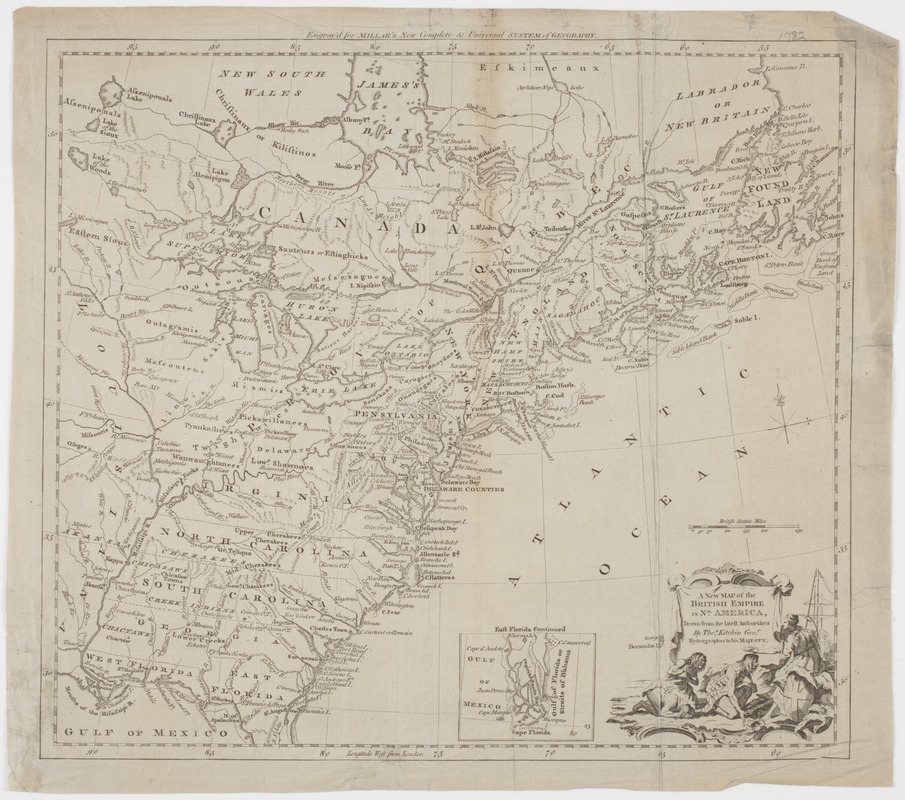
A new map of the British empire in Nth. America
This map is also available in American Revolutionary Geographies Online (ARGO), a collections portal especially built for material relating to the American Revolutionary War Era. Visit ARGO to learn more about this item and explore the historical geography of North America in the late eighteenth century.
Item Information
- Title:
- A new map of the British empire in Nth. America
- Description:
-
Subject: Map of the United States and Canada, est of the Mississippi River. Shows locations of native American peoples throughout. Cartouche at lower right depicts an allegorical female figure of Britain holding a halo over a kneeling Native American. A second Native American man kneels behind the first.
- Creator:
- Kitchin, Thomas, 1718-1784
- Name on Item:
-
drawn from the latest authorities by Thos. Kitchin geor. hydrographer to His Majesty.
- Date:
-
[1782]
- Format:
-
Maps/Atlases
- Location:
- American Antiquarian Society
- Collection (local):
-
American Antiquarian Society Collection
- Subjects:
-
Indians of North America--Pictorial works
United States--Maps
Canada--Maps
- Places:
-
United States
Canada
- Extent:
- 1 map : engraving ; 34 x 38 cm., on sheet 37 x 41 cm.
- Terms of Use:
-
Public Domain/No known restrictions on use. Contact host institution to download image.
Contact host institution for more information.
- Publisher:
-
London :
[s.n.]
- Scale:
-
Scale [ca. 1:9,000,000]
- Language:
-
English
- Catalog Record:
-
http://catalog.mwa.org/vwebv/holdingsInfo?bibId=489833
- Notes:
-
Relief shown pictorially.
Inset: East Florida continued.
"Engrav'd for Millar's New complete & universal system of geography."
From Millar, G. The new and universal system of geography, London, 1782.
- Notes (date):
-
This date is inferred.


