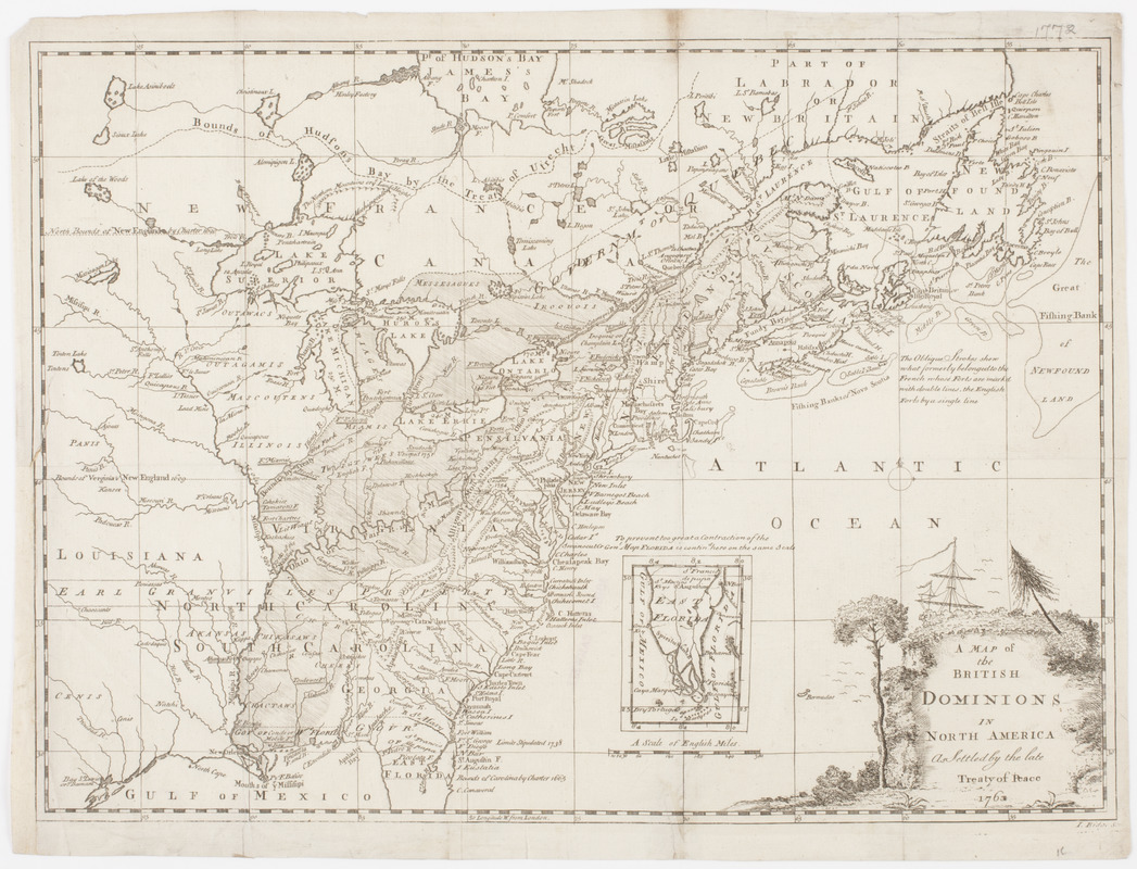
A Map of the British dominions in North America as settled by the late treaty of Peace 1763
This map is also available in American Revolutionary Geographies Online (ARGO), a collections portal especially built for material relating to the American Revolutionary War Era. Visit ARGO to learn more about this item and explore the historical geography of North America in the late eighteenth century.
Item Information
- Title:
- A Map of the British dominions in North America as settled by the late treaty of Peace 1763
- Title (uniform):
-
Voyage to North America
- Description:
-
Subject: Map of the United States and Canada, showing the new boundaries that resulted after the French and Indian war.
- Donor:
- Farwell, John Whittemore, 1843-1929
- Engraver:
- Ridge, J.
- Name on Item:
-
I. Ridge sc.
- Date:
-
[1766]
- Format:
-
Maps/Atlases
- Location:
- American Antiquarian Society
- Collection (local):
-
American Antiquarian Society Collection
- Subjects:
-
United States--History--French and Indian War, 1754-1763--Maps
United States--Maps
Canada--Maps
- Places:
-
United States
Canada
- Extent:
- 1 map : engraving ; 28 x 38 cm., on sheet 30 x 39 cm.
- Terms of Use:
-
Public Domain/No known restrictions on use. Contact host institution to download image.
Contact host institution for more information.
- Publisher:
-
Dublin :
[s.n.]
- Scale:
-
Scale [ca. 1:8,800,000]
- Language:
-
English
- Catalog Record:
-
http://catalog.mwa.org/vwebv/holdingsInfo?bibId=489329
- Notes:
-
Relief shown pictorially.
From A voyage to North America, Dublin, 1766.
- Notes (date):
-
This date is inferred.


