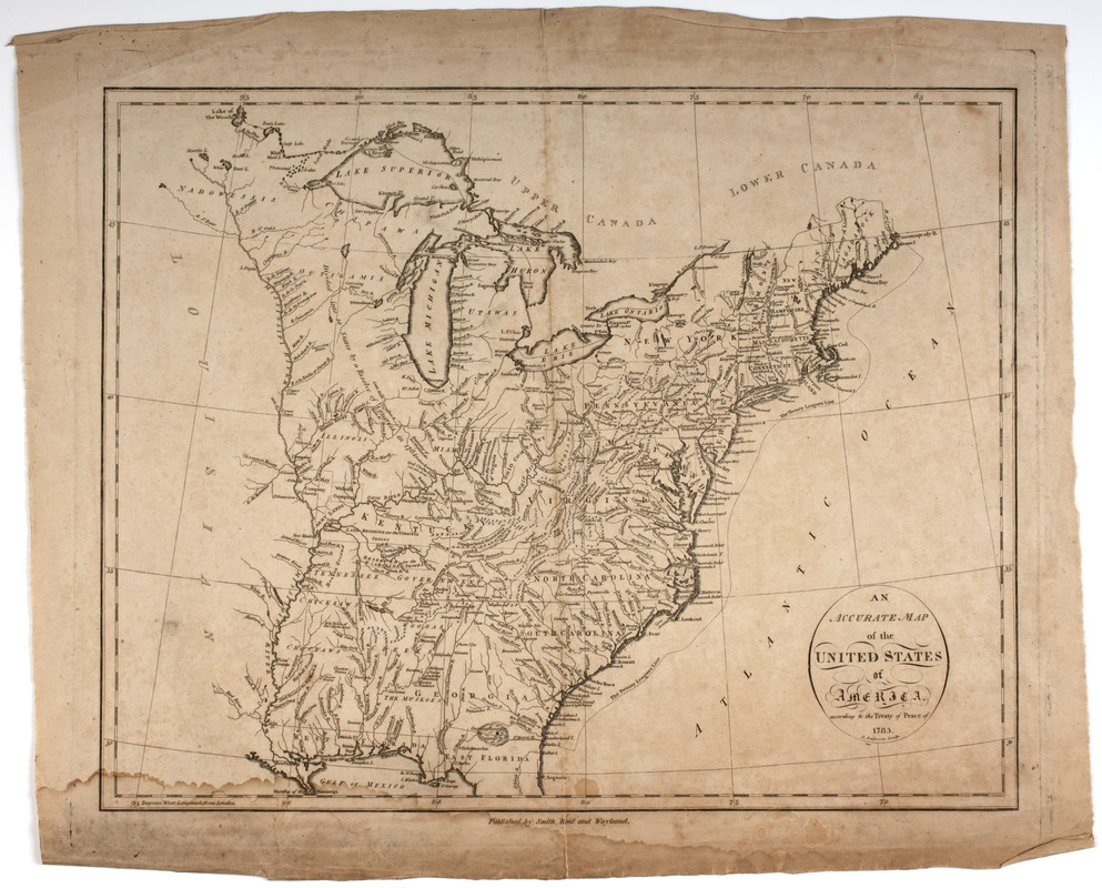
An Accurate map of the United States of America. : According to the Treaty of Peace of 1783
This map is also available in American Revolutionary Geographies Online (ARGO), a collections portal especially built for material relating to the American Revolutionary War Era. Visit ARGO to learn more about this item and explore the historical geography of North America in the late eighteenth century.
Item Information
- Title:
- An Accurate map of the United States of America. : According to the Treaty of Peace of 1783
- Title (uniform):
-
American atlas
- Description:
-
Subject: Map of the land of the United States after the peace treaty of 1783. Shows land extending west to the Mississippi River and south to Florida. Also shows the lands belonging to the different Native American nations.
- Engraver:
- Anderson, Alexander, 1775-1870
- Publisher:
- Smith, Reid & Wayland
- Name on Item:
-
A. Anderson sculp.
- Date:
-
[1796]
- Format:
-
Maps/Atlases
- Location:
- American Antiquarian Society
- Collection (local):
-
American Antiquarian Society Collection
- Subjects:
-
Indians of North America--Land tenure
United States--Foreign relations--1775-1783
United States--Maps
- Places:
-
- Extent:
- 1 map ; 36 x 46 cm., on sheet 43 x 52.5 cm.
- Terms of Use:
-
Public Domain/No known restrictions on use. Contact host institution to download image.
Contact host institution for more information.
- Publisher:
-
[New York] :
Published by Smith, Reid and Wayland.
- Scale:
-
Scale [ca. 1:6,500,000]
- Language:
-
English
- Catalog Record:
-
http://catalog.mwa.org/vwebv/holdingsInfo?bibId=475952
- Notes:
-
Prime meridian: London.
Relief shown pictorially.
From The American Atlas, New York : Published by John Reid, 1796 (Evans 31078).
- Notes (date):
-
This date is inferred.


