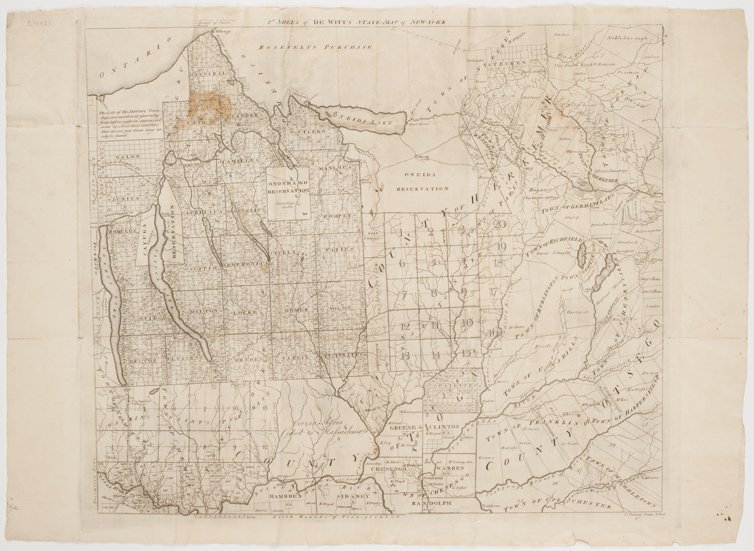
1st. sheet of De Witt's state-map of New York
This map is also available in American Revolutionary Geographies Online (ARGO), a collections portal especially built for material relating to the American Revolutionary War Era. Visit ARGO to learn more about this item and explore the historical geography of North America in the late eighteenth century.
Item Information
- Title:
- 1st. sheet of De Witt's state-map of New York
- Title (alt.):
-
De Witt's State-map of New-York
- Description:
-
Subject: Map of the state of New York, showing locations of Indian reservations and land ceded to Massachusetts.
- Artist:
- De Witt, Simeon, 1756-1834
- Engraver:
- Tiebout, Cornelius, 1777-1832
- Name on Item:
-
C. Tiebout sculp. N. York.
- Date:
-
[1792]
- Format:
-
Maps/Atlases
- Location:
- American Antiquarian Society
- Collection (local):
-
American Antiquarian Society Collection
- Subjects:
-
New York (State)--Maps
- Places:
-
New York
- Extent:
- 1 map : engraving
- Terms of Use:
-
Public Domain/No known restrictions on use. Contact host institution to download image.
Contact host institution for more information.
- Publisher:
-
Albany :
[s.n.]
- Scale:
-
Scale [ca. 1:380,000]
- Language:
-
English
- Catalog Record:
-
http://catalog.mwa.org/vwebv/holdingsInfo?bibId=464842
- Notes:
-
Copyright October 26, 1792, according to Evans.
- Notes (date):
-
This date is inferred.


