New Hampshire
This map is also available in American Revolutionary Geographies Online (ARGO), a collections portal especially built for material relating to the American Revolutionary War Era. Visit ARGO to learn more about this item and explore the historical geography of North America in the late eighteenth century.
Item Information
- Title:
- New Hampshire
- Description:
-
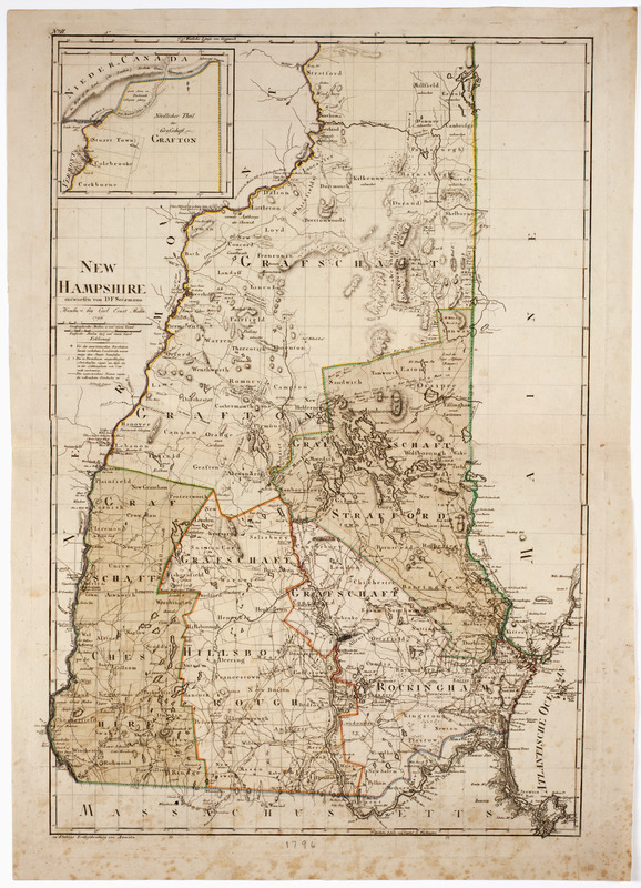
Subject: Map of the state of New Hampshire divided into counties and towns. The northernmost part of New Hampshire is seen in a continuation in the upper left corner.
- Creator:
- Sotzmann, D. F.
- Publisher:
- Bohn, Carl Ernst
- Name on Item:
-
entworfen von D.F. Sotzmann.
- Date:
-
1796
- Format:
-
Maps/Atlases
- Location:
- American Antiquarian Society
- Collection (local):
-
American Antiquarian Society Collection
- Subjects:
-
New Hampshire--Maps
- Places:
-
New Hampshire
- Extent:
- 1 map : engraving, hand colored ; 67 x 45 cm., on sheet 74 x 53 cm.
- Terms of Use:
-
Public Domain/No known restrictions on use. Contact host institution to download image.
Contact host institution for more information.
- Publisher:
-
Hamburg :
bey Carl Ernst Bohn
- Scale:
-
Scale [ca. 1:380,160]
- Language:
-
English
- Catalog Record:
-
http://catalog.mwa.org/vwebv/holdingsInfo?bibId=487644
- Notes:
-
Prime meridian: Greenwich and Washington, D.C.
Relief shown by hachures.
At upper left corner: No. II.
"Zu Ebelings Erdbeschreibung von Amerika."
From Ebeling, C.D. Géographie générale et histoire des États-Unis de l'Amérique septentrionale.


