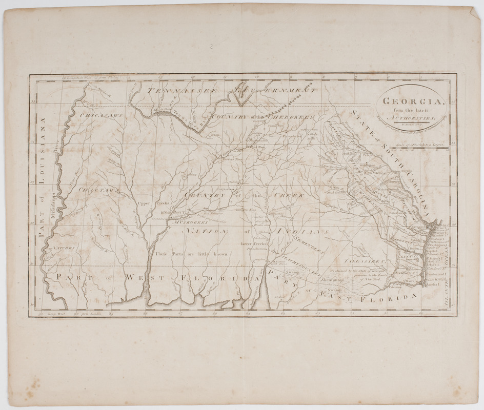
Georgia from the latest authorities
This map is also available in American Revolutionary Geographies Online (ARGO), a collections portal especially built for material relating to the American Revolutionary War Era. Visit ARGO to learn more about this item and explore the historical geography of North America in the late eighteenth century.
Item Information
- Title:
- Georgia from the latest authorities
- Title (uniform):
-
General atlas for Carey's edition of Guthrie's geography improved
- Description:
-
Subject: Map of the state of Georgia showing different Native American lands within the state.
- Engraver:
- Barker, W. (William), active 1795-1803
- Publisher:
- M. Carey (Firm)
- Name on Item:
-
W. Barker sculpt.
- Date:
-
[1795]
- Format:
-
Maps/Atlases
- Location:
- American Antiquarian Society
- Collection (local):
-
American Antiquarian Society Collection
- Subjects:
-
Georgia--Maps
- Places:
-
Georgia
- Extent:
- 1 map : engraving ; 23 x 41 cm., on sheet 38 x 45 cm.
- Terms of Use:
-
Public Domain/No known restrictions on use. Contact host institution to download image.
Contact host institution for more information.
- Publisher:
-
Philadelphia :
Mathew Carey
- Scale:
-
Scale [ca. 1:3,000,000]
- Language:
-
English
- Catalog Record:
-
http://catalog.mwa.org/vwebv/holdingsInfo?bibId=476145
- Notes:
-
Relief shown pictorially.
From General atlas for Carey's edition of Guthrie's geography improved, Philadelphia, 1795 (Bristol B9043; Shipton & Mooney 47370).
"Engraved for Carey's American edition of Guthrie's geography."
State I.
- Notes (date):
-
This date is inferred.


