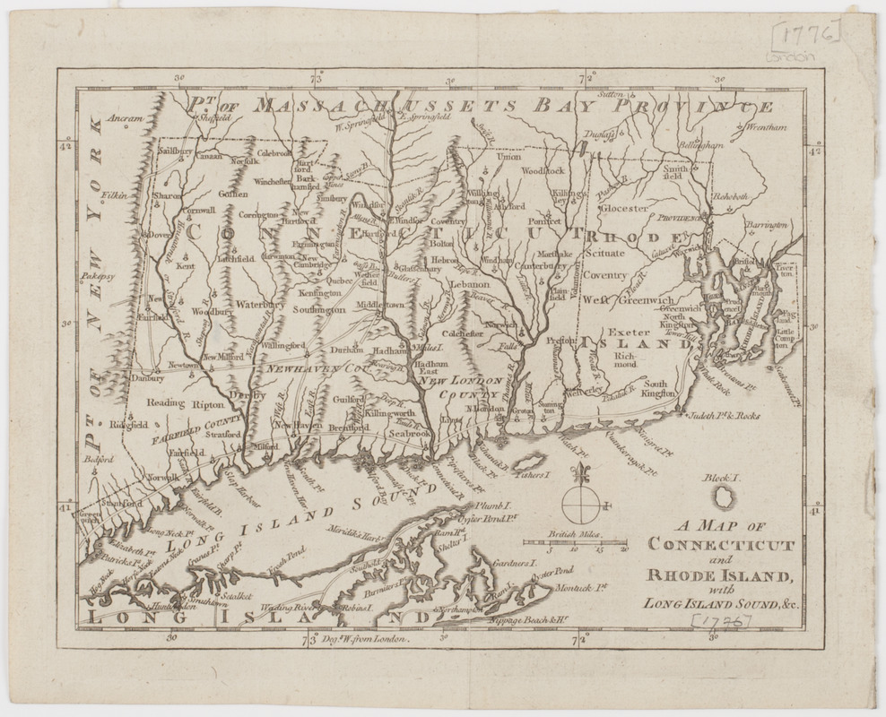
A Map of Connecticut and Rhode Island, with Long Island Sound, &c
This map is also available in American Revolutionary Geographies Online (ARGO), a collections portal especially built for material relating to the American Revolutionary War Era. Visit ARGO to learn more about this item and explore the historical geography of North America in the late eighteenth century.
Item Information
- Title:
- A Map of Connecticut and Rhode Island, with Long Island Sound, &c
- Title (uniform):
-
Gentleman's magazine (London, England)
- Description:
-
Subject: Map of Connecticut and Rhode Island showing major roadways, and a copper mine near Simsbury.
- Date:
-
[1776]
- Format:
-
Maps/Atlases
- Location:
- American Antiquarian Society
- Collection (local):
-
American Antiquarian Society Collection
- Subjects:
-
Connecticut--Maps
Rhode Island--Maps
Long Island Sound (N.Y. and Conn.)--Maps
- Places:
-
Connecticut
Long Island Sound (bay)
Rhode Island
- Extent:
- 1 map : engraving ; 17.5 x 23 cm., on sheet 21 x 26 cm.
- Terms of Use:
-
Public Domain/No known restrictions on use. Contact host institution to download image.
Contact host institution for more information.
- Publisher:
-
London :
[s.n.]
- Scale:
-
Scale [ca. 1:1,000,000]
- Language:
-
English
- Catalog Record:
-
http://catalog.mwa.org/vwebv/holdingsInfo?bibId=485856
- Notes:
-
Relief shown pictorially.
From the Gentleman's magazine, November, 1776.
- Notes (date):
-
This date is inferred.


