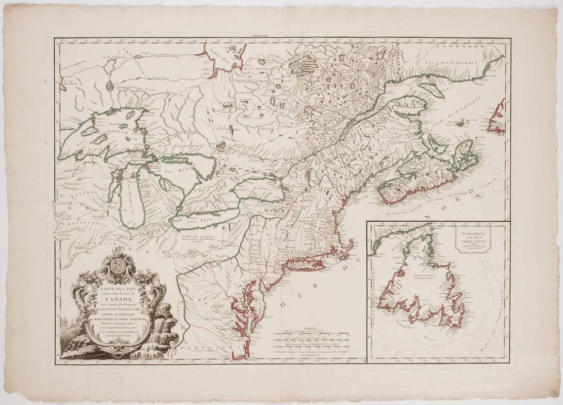
Carte des pays connus sous le nom de Canada, : dans laquelle sont distinguées les possessions françoises, et angl?
This map is also available in American Revolutionary Geographies Online (ARGO), a collections portal especially built for material relating to the American Revolutionary War Era. Visit ARGO to learn more about this item and explore the historical geography of North America in the late eighteenth century.
Item Information
- Title:
- Carte des pays connus sous le nom de Canada, : dans laquelle sont distinguées les possessions françoises, et angl?
- Description:
-
Subject: Map of Canada including Newfoundland west to the Great Lakes, the United States from New England south to Carolina, and the northern portion Louisiana. Includes decorative cartouche with waterfall.
- Creator:
- Robert de Vaugondy, Didier, 1723-1786
- Name on Item:
-
Dediée et présentée a monseigneur le Comte d'Argenson ministre sécrétaire d'état pour le département de la guerre, par le Sr. Robert de Vaugondy fils géographe ordinaire du Roi.
- Date:
-
1753
- Format:
-
Maps/Atlases
- Location:
- American Antiquarian Society
- Collection (local):
-
American Antiquarian Society Collection
- Subjects:
-
United States--Maps
Canada--Maps
Louisiana--History--To 1803--Maps
- Places:
-
United States
Louisiana
Canada
- Extent:
- 1 map : engraving, hand colored ; 48 x 67 cm., on sheet 58 x 82 cm.
- Terms of Use:
-
Public Domain/No known restrictions on use. Contact host institution to download image.
Contact host institution for more information.
- Publisher:
-
A Paris :
Chés l'auteur, quai de l'Horlage du Palais proche le Pont-Neuf. Avec privilege
- Scale:
-
Scale [ca. 1:3,920,000]
- Language:
-
French
- Catalog Record:
-
http://catalog.mwa.org/vwebv/holdingsInfo?bibId=478887
- Notes:
-
Relief shown pictorially.
Inset: Supplément pour l'Isle de Terre-Neuve.


