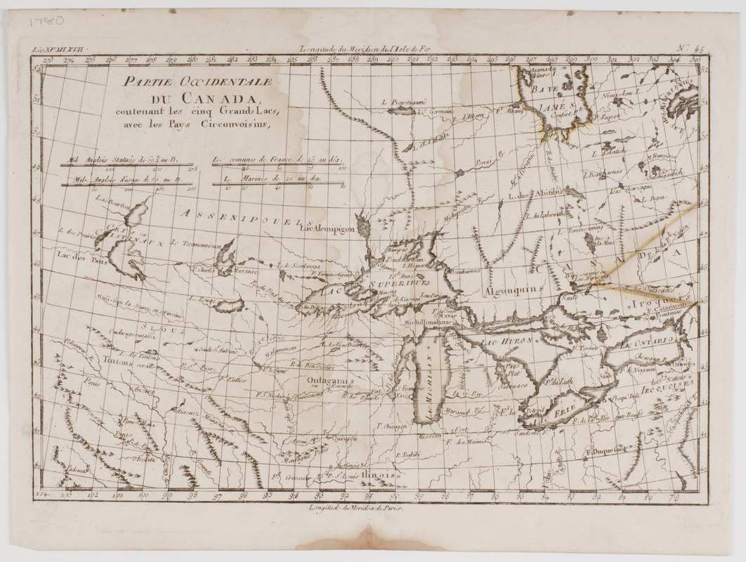
Partie occidentale du Canada, : contenant les cinq Grands Lacs, avec les pays circonvoisins
This map is also available in American Revolutionary Geographies Online (ARGO), a collections portal especially built for material relating to the American Revolutionary War Era. Visit ARGO to learn more about this item and explore the historical geography of North America in the late eighteenth century.
Item Information
- Title:
- Partie occidentale du Canada, : contenant les cinq Grands Lacs, avec les pays circonvoisins
- Description:
-
Subject: Map of the southern portion of Canada and the northern United States, including the Great Lakes."
- Creator:
- Bonne, Rigobert, 1727-1794
- Name on Item:
-
par M. Bonne, ingenieur-hydrographe de la marine.
- Date:
-
[1780]
- Format:
-
Maps/Atlases
- Location:
- American Antiquarian Society
- Collection (local):
-
American Antiquarian Society Collection
- Subjects:
-
United States--Maps
Canada--Maps
Great Lakes (North America)--Maps
- Places:
-
Great Lakes
United States
Canada
- Extent:
- 1 map : engraving ; 21 x 32 cm., on sheet 26 x 34 cm.
- Terms of Use:
-
Public Domain/No known restrictions on use. Contact host institution to download image.
Contact host institution for more information.
- Publisher:
-
Paris :
[s.n.]
- Scale:
-
Scales vary
- Language:
-
English
- Catalog Record:
-
http://catalog.mwa.org/vwebv/holdingsInfo?bibId=478842
- Notes:
-
Prime meridian: Paris and Ferro.
Relief shown pictorially.
"Liv. XV-XVI-XVII. No. 45."
- Notes (date):
-
This date is inferred.


