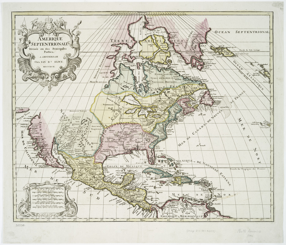
Amerique septentrionale divisée en ses principales parties
This map is also available in American Revolutionary Geographies Online (ARGO), a collections portal especially built for material relating to the American Revolutionary War Era. Visit ARGO to learn more about this item and explore the historical geography of North America in the late eighteenth century.
Item Information
- Title:
- Amerique septentrionale divisée en ses principales parties
- Creator:
- Elwe, Jan Barend
- Date:
-
1792
- Format:
-
Maps/Atlases
- Location:
- New York Public Library
- Collection (local):
-
Maps of North America
- Subjects:
-
North America--Maps
- Places:
-
North America (area)
- Extent:
- 1 map : hand col. ; 46 x 57 cm.
- Terms of Use:
-
No known copyright restrictions.
This work is licensed for use under a Creative Commons Attribution Non-Commercial Share Alike License (CC BY-NC-SA).

- Publisher:
-
Amsterdam :
Chés Ian Bt. Elwe
- Scale:
-
Scale [ca. 1:18,500,000]
- Language:
-
French
- Catalog Record:
-
https://digitalcollections.nypl.org/items/510d47da-f0b1-a3d9-e040-e00a18064a99
- Notes:
-
Relief shown pictorially.
Prime meridian: Ferro.
Appears in Jan Barend Elwe's Atlas. 1792.


![[Map of Spanish Louisiana and the American colonies]](https://bpldcassets.blob.core.windows.net/derivatives/images/commonwealth:z603vq85r/image_thumbnail_300.jpg)
