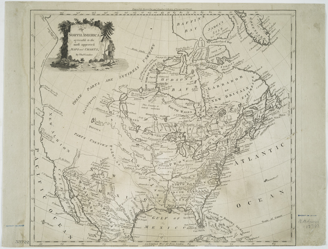
North America, agreeable to the most approved maps and charts
This map is also available in American Revolutionary Geographies Online (ARGO), a collections portal especially built for material relating to the American Revolutionary War Era. Visit ARGO to learn more about this item and explore the historical geography of North America in the late eighteenth century.
Item Information
- Title:
- North America, agreeable to the most approved maps and charts
- Creator:
- Conder, Thomas, 1746 or 1747-1831
- Name on Item:
-
by Thos. Conder.
- Date:
-
[1774?]
- Format:
-
Maps/Atlases
- Location:
- New York Public Library
- Collection (local):
-
Maps of North America
- Subjects:
-
North America--Maps--Early works to 1800
- Places:
-
North America (area)
- Extent:
- 1 map ; 33 x 37 cm
- Terms of Use:
-
No known copyright restrictions.
This work is licensed for use under a Creative Commons Attribution Non-Commercial Share Alike License (CC BY-NC-SA).

- Publisher:
-
[London?] :
[publisher not identified]
- Scale:
-
Scale [ca. 1:19,000,000]
- Language:
-
English
- Catalog Record:
-
https://digitalcollections.nypl.org/items/510d47da-f0ab-a3d9-e040-e00a18064a99
- Notes:
-
Relief shown pictorially.
Prime meridian: London.
"Engraved for Moore's New and compleat collection of voyages and travels."
Includes decorative cartouche.


