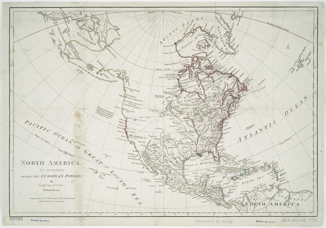
North America, as divided amongst the European powers
This map is also available in American Revolutionary Geographies Online (ARGO), a collections portal especially built for material relating to the American Revolutionary War Era. Visit ARGO to learn more about this item and explore the historical geography of North America in the late eighteenth century.
Item Information
- Title:
- North America, as divided amongst the European powers
- Creator:
- Dunn, Samuel, -1794
- Contributor:
- Sayer, Robert, 1725-1794
- Name on Item:
-
by Samuel Dunn, mathematician.
- Date:
-
1774
- Format:
-
Maps/Atlases
- Location:
- New York Public Library
- Collection (local):
-
Maps of North America
- Subjects:
-
North America--Maps--Early works to 1800
- Places:
-
North America (area)
- Extent:
- 1 map : hand color ; 30 x 44 cm.
- Terms of Use:
-
No known copyright restrictions.
This work is licensed for use under a Creative Commons Attribution Non-Commercial Share Alike License (CC BY-NC-SA).

- Publisher:
-
London :
Printed for Robt. Sayer
- Scale:
-
Scale indeterminable
- Language:
-
English
- Catalog Record:
-
https://digitalcollections.nypl.org/items/510d47da-f0ac-a3d9-e040-e00a18064a99
- Notes:
-
Relief shown pictorially.
Prime meridian: Ferro.
Appears in the American Military Pocket Atlas.
- LCCN:
-
74694267


