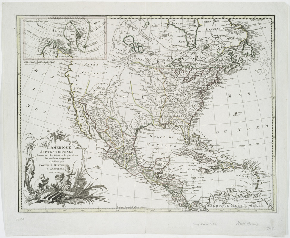
L'Amérique septentrionale
This map is also available in American Revolutionary Geographies Online (ARGO), a collections portal especially built for material relating to the American Revolutionary War Era. Visit ARGO to learn more about this item and explore the historical geography of North America in the late eighteenth century.
Item Information
- Title:
- L'Amérique septentrionale
- Creator:
- Cóvens et Mortier
- Name on Item:
-
dressée sur les mémoires le plus récens des meilleurs géographes, & publiée par Cóvens & Mortier.
- Date:
-
1757
- Format:
-
Maps/Atlases
- Location:
- New York Public Library
- Collection (local):
-
Lawrence H. Slaughter Collection of English maps, charts, globes, books and atlases
- Subjects:
-
North America--Maps--Early works to 1800
- Places:
-
North America (area)
- Extent:
- col. map 46 x 61 cm.
- Terms of Use:
-
No known copyright restrictions.
This work is licensed for use under a Creative Commons Attribution Non-Commercial Share Alike License (CC BY-NC-SA).

- Scale:
-
Scale ca. 1:12,500,000
- Language:
-
French
- Catalog Record:
-
https://digitalcollections.nypl.org/items/510d47db-c439-a3d9-e040-e00a18064a99
- Notes:
-
Hand colored.
Relief shown pictorially.
Shows the Mississippi River to be the eastern boundary of Louisiana.
From the author's Atlas nouveau, [1761?], v. 9, no. 34.
Includes inset of the Arctic regions.
- LCCN:
-
75691627


