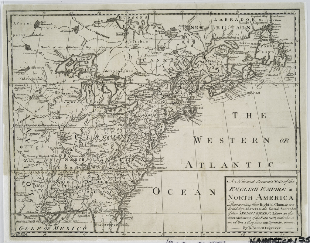
A new and accurate map of the English empire in North America : representing their rightful claim as confirm'd by charters, and the formal surrender of their Indian friends ; likewise the encroachments of the French, with the several forts they have unjustly erected therein
This map is also available in American Revolutionary Geographies Online (ARGO), a collections portal especially built for material relating to the American Revolutionary War Era. Visit ARGO to learn more about this item and explore the historical geography of North America in the late eighteenth century.
Item Information
- Title:
- A new and accurate map of the English empire in North America : representing their rightful claim as confirm'd by charters, and the formal surrender of their Indian friends ; likewise the encroachments of the French, with the several forts they have unjustly erected therein
- Title (uniform):
-
Grand magazine of universal intelligence and monthly chronicle of our own times
- Creator:
- Bennett, Richard
- Contributor:
- Griffiths, Ralph, 1720-1803
- Name on Item:
-
by R. Bennett engraver.
- Date:
-
[1758]
- Format:
-
Maps/Atlases
- Location:
- New York Public Library
- Collection (local):
-
Maps of North America
- Subjects:
-
North America--Maps--Early works to 1800
Great Britain--Colonies--America--Maps--Early works to 1800
- Places:
-
North America (area)
- Extent:
- 1 map ; 25 x 33 cm.
- Terms of Use:
-
No known copyright restrictions.
This work is licensed for use under a Creative Commons Attribution Non-Commercial Share Alike License (CC BY-NC-SA).

- Publisher:
-
London :
R. Griffiths
- Scale:
-
Scale [ca. 1:11,000,000]
- Language:
-
English
- Catalog Record:
-
https://digitalcollections.nypl.org/items/510d47da-ee87-a3d9-e040-e00a18064a99
- Notes:
-
Relief shown by hachures.
From Grand magazine of universal intelligence and monthly chronicle of our own times, v. 1, October 1758.
- Notes (date):
-
This date is inferred.


