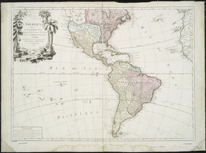
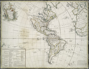
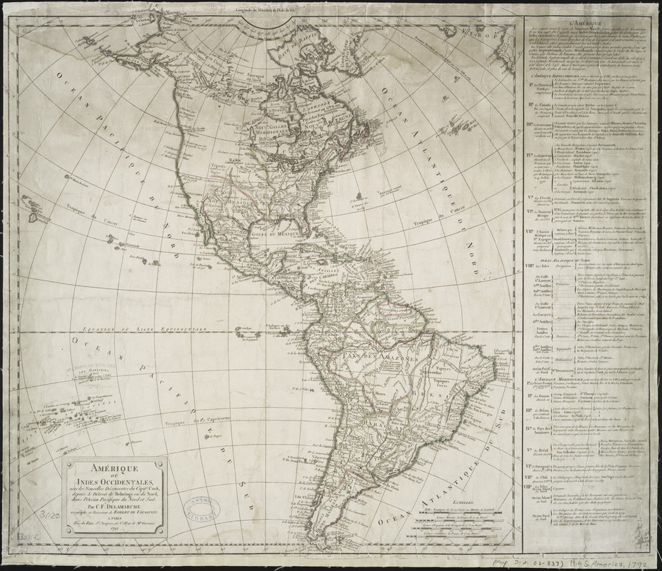
Amérique ou Indes Occidentales, avec les nouvelles découvertes du Capit'e Cook, depuis le Détroit de Behrings ou du Nord, dans l'Océan Pacifique du Nord et Sud
This map is also available in American Revolutionary Geographies Online (ARGO), a collections portal especially built for material relating to the American Revolutionary War Era. Visit ARGO to learn more about this item and explore the historical geography of North America in the late eighteenth century.
Item Information
- Title:
- Amérique ou Indes Occidentales, avec les nouvelles découvertes du Capit'e Cook, depuis le Détroit de Behrings ou du Nord, dans l'Océan Pacifique du Nord et Sud
- Creator:
- Delamarche, Charles François, 1740-1817
- Name on Item:
-
par C.F. Delamarche, géographe et successeur de Robert de Vaugondy.
- Date:
-
1792
- Format:
-
Maps/Atlases
- Location:
- New York Public Library
- Collection (local):
-
Maps of North and South America
- Subjects:
-
America--Maps--Early works to 1800
- Places:
-
North America (area)
South America
Mesoamerica (area)
- Extent:
- 1 map : hand col. ; 56 x 50 cm.
- Terms of Use:
-
No known copyright restrictions.
This work is licensed for use under a Creative Commons Attribution Non-Commercial Share Alike License (CC BY-NC-SA).

- Publisher:
-
Paris :
C.F. Delamarche
- Scale:
-
Scale [ca. 1:19,500,000]
- Language:
-
English
- Catalog Record:
-
https://digitalcollections.nypl.org/items/510d47db-b01f-a3d9-e040-e00a18064a99
- Notes:
-
Relief shown pictorially.
Prime meridians: Paris and Ferro.
Includes notes and numbered discriptive list of major sections of North and South America.
- LCCN:
-
96688046