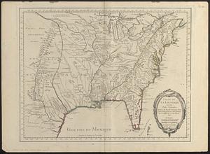
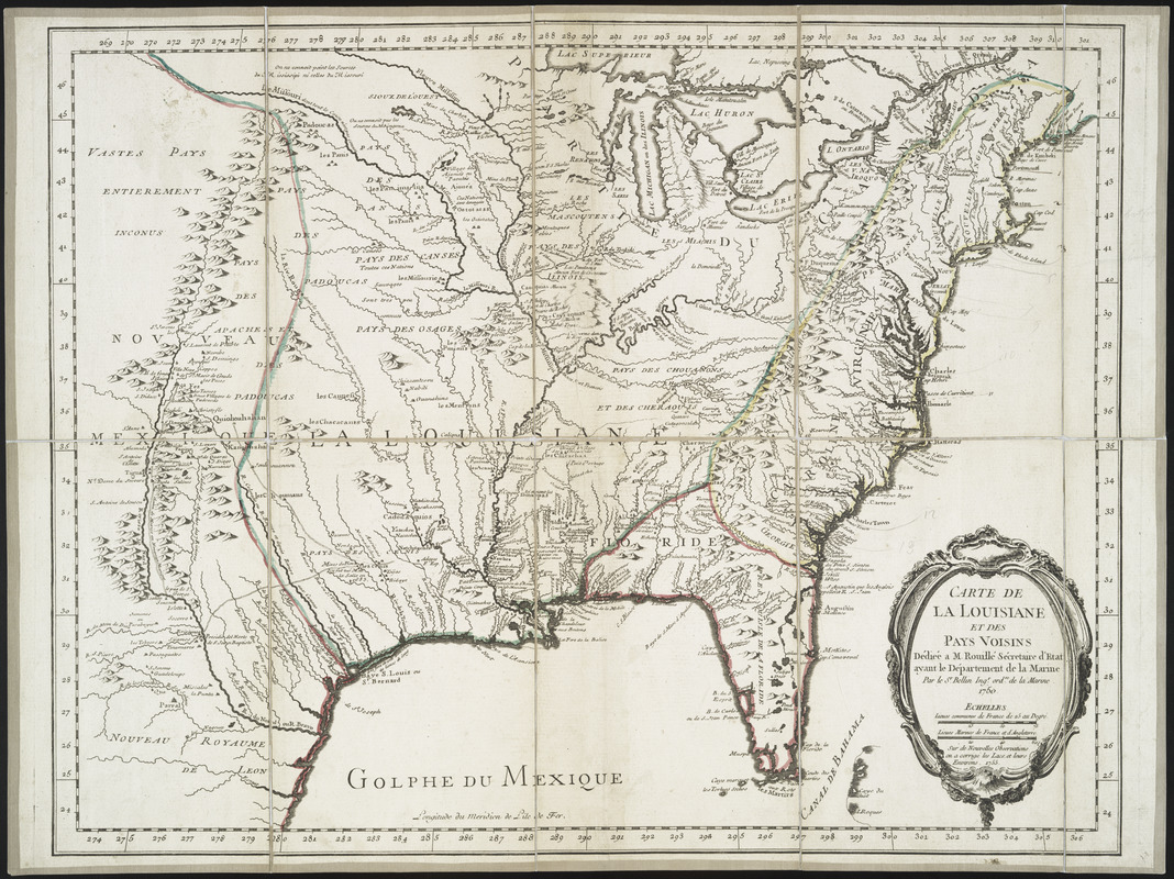
Carte de la Louisiane et des pays voisins : dédiée à M. Rouillé, sécretaire d'État, ayant le Département de la marine
This map is also available in American Revolutionary Geographies Online (ARGO), a collections portal especially built for material relating to the American Revolutionary War Era. Visit ARGO to learn more about this item and explore the historical geography of North America in the late eighteenth century.
Item Information
- Title:
- Carte de la Louisiane et des pays voisins : dédiée à M. Rouillé, sécretaire d'État, ayant le Département de la marine
- Creator:
- Bellin, Jacques Nicolas, 1703-1772
- Contributor:
- France. Dépôt des cartes et plans de la marine
- Name on Item:
-
Par le Sr. Bellin, ingr. ordre. de la marine, 1750.
- Date:
-
[1755?]
- Format:
-
Maps/Atlases
- Location:
- New York Public Library
- Collection (local):
-
Lawrence H. Slaughter Collection of English maps, charts, globes, books and atlases
- Subjects:
-
North America--Maps--Early works to 1800
Louisiana--Maps--Early works to 1800
- Places:
-
Louisiana
North America (area)
- Extent:
- map 48 x 61 cm.
- Terms of Use:
-
No known copyright restrictions.
This work is licensed for use under a Creative Commons Attribution Non-Commercial Share Alike License (CC BY-NC-SA).

- Scale:
-
Scale ca. 1:5,800,000
- Language:
-
French
- Catalog Record:
-
https://digitalcollections.nypl.org/items/510d47df-f8e7-a3d9-e040-e00a18064a99
- Notes:
-
Longitude du méridien de l'île de Fer.
Covers the area from Québec to the Gulf of Mexico and west of Santa Fé, N.M.
Relief shown pictorially.
Shows cities and towns, forts, some trails, and Indian villages and tribal territory.
"Sur de nouvelles observations on à corrigé les lacs, et leurs environs, 1755."
Stamped on: Depôt des cartes et journ. de la marine.
- LCCN:
-
74692884