Territory of Columbia
This map is also available in American Revolutionary Geographies Online (ARGO), a collections portal especially built for material relating to the American Revolutionary War Era. Visit ARGO to learn more about this item and explore the historical geography of North America in the late eighteenth century.
Item Information
- Title:
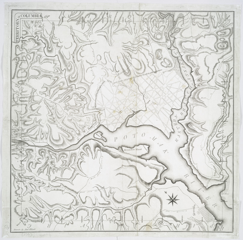
- Territory of Columbia
- Creator:
- Ellicott, Andrew, 1754-1820
- Name on Item:
-
drawn by And'w Ellicott.
- Date:
-
[1794]
- Format:
-
Maps/Atlases
- Location:
- New York Public Library
- Collection (local):
-
Lawrence H. Slaughter Collection of English maps, charts, globes, books and atlases
- Subjects:
-
Washington (D.C.)--Maps
Arlington County (Va.)--Maps
- Places:
-
Arlington (county)
Washington
- Extent:
- 1 map ; 56 x 55 cm.
- Terms of Use:
-
No known copyright restrictions.
This work is licensed for use under a Creative Commons Attribution Non-Commercial Share Alike License (CC BY-NC-SA).

- Publisher:
-
Philadelphia? :
[s.n.]
- Scale:
-
Scale [ca. 1:31,680]
- Language:
-
English
- Catalog Record:
-
https://digitalcollections.nypl.org/items/510d47da-edef-a3d9-e040-e00a18064a99
- Notes:
-
Relief shown by hachures.
Printed along city boundary: Out lines of the city of Washington with the grand avenues and principal streets leading through the public appropriations.
Oriented with north toward the upper left.
- Notes (date):
-
This date is inferred.
- LCCN:
-
88694123


