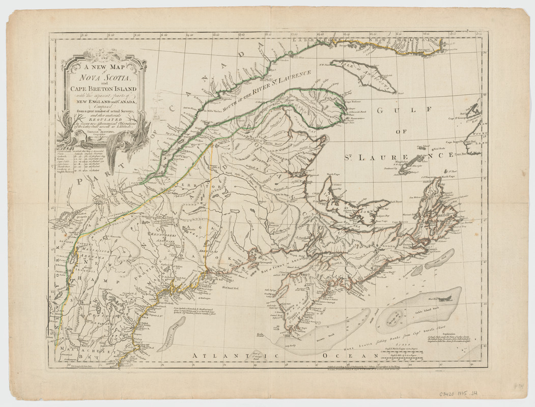
A new map of Nova Scotia and Cape Breton Island : with the adjacent parts of New England and Canada composed from a great number of actual surveys; and other materials regulated by many new astronomical observations of the longitude as well as latitude
This map is also available in American Revolutionary Geographies Online (ARGO), a collections portal especially built for material relating to the American Revolutionary War Era. Visit ARGO to learn more about this item and explore the historical geography of North America in the late eighteenth century.
Item Information
- Title:
- A new map of Nova Scotia and Cape Breton Island : with the adjacent parts of New England and Canada composed from a great number of actual surveys; and other materials regulated by many new astronomical observations of the longitude as well as latitude
- Creator:
- Jefferys, Thomas, -1771
- Contributor:
- Robert Sayer and John Bennett (Firm)
- Name on Item:
-
by Thomas Jefferys, geographer to the King.
- Date:
-
1775
- Format:
-
Maps/Atlases
- Location:
- Harvard Library
- Collection (local):
-
Harvard Map Collection
- Subjects:
-
Nova Scotia--Maps--Early works to 1800
Maritime Provinces--Maps--Early works to 1800
New England--Maps--Early works to 1800
Saint Lawrence River Valley--Maps--Early works to 1800
Canada--Maps--Early works to 1800
- Places:
-
New England (area)
Saint Lawrence River
CanadaNova Scotia (province)
- Extent:
- 1 map : hand col. ; 47 x 61 cm.
- Terms of Use:
-
No known copyright restrictions.
This work is licensed for use under a Creative Commons Attribution Non-Commercial Share Alike License (CC BY-NC-SA).

- Publisher:
-
London :
Printed & sold by R. Sayer & J. Bennett
- Scale:
-
Scale [ca. 1:1,900,000]
- Language:
-
English
- Catalog Record:
-
http://id.lib.harvard.edu/aleph/011316075/catalog
- Notes:
-
Shows Maritime Provinces, New England, and St. Lawrence Valley region to Montreal.
Relief shown pictorially. Depths shown by soundings.
"VII" located above upper right corner of border.
From the author's The American atlas. 1775.
Includes table of sources of observations.
Historiated title cartouche.
- LCCN:
-
73696223


