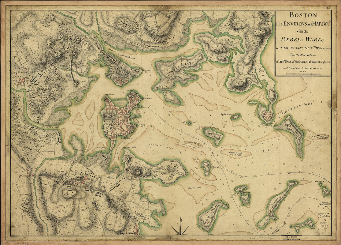
Boston, its environs and harbour : with the rebels works raised against that town in 1775
This map is also available in American Revolutionary Geographies Online (ARGO), a collections portal especially built for material relating to the American Revolutionary War Era. Visit ARGO to learn more about this item and explore the historical geography of North America in the late eighteenth century.
Item Information
- Title:
- Boston, its environs and harbour : with the rebels works raised against that town in 1775
- Creator:
- Page, Thomas Hyde, Sir, 1746-1821
- Name on Item:
-
from the observations of Lieut. Page of His Majesty's Corps of Engineers, and from those of other gentlemen.
- Date:
-
[1775?]
- Format:
-
Maps/Atlases
Manuscripts
- Location:
- Library of Congress Geography and Map Division
- Collection (local):
-
Library of Congress Geography and Map Division
- Subjects:
-
Boston (Mass.)--History--Siege, 1775-1776--Maps--Early works to 1800
Fortification--Massachusetts--Boston--Maps--Early works to 1800
Harbors--Massachusetts--Boston--Maps--Early works to 1800
Boston (Mass.)--Buildings, structures, etc--Maps--Early works to 1800
Manuscript maps--Early works to 1800
- Places:
-
Suffolk (county)Boston
- Extent:
- col. map 45 x 64 cm.
- Terms of Use:
-
No known copyright restrictions.
This work is licensed for use under a Creative Commons Attribution Non-Commercial Share Alike License (CC BY-NC-SA).

- Scale:
-
Scale ca. 1:24,000
- Language:
-
English
- Catalog Record:
-
https://lccn.loc.gov/gm71000623
- Notes:
-
Manuscript, pen-and-ink and watercolor.
Relief shown by hachures. Depths shown by soundings.
- LCCN:
-
gm 71000623


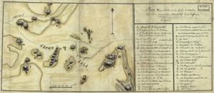
![[Rough draught of Boston and harbour]](https://bpldcassets.blob.core.windows.net/derivatives/images/commonwealth:z603vj39m/image_thumbnail_300.jpg)