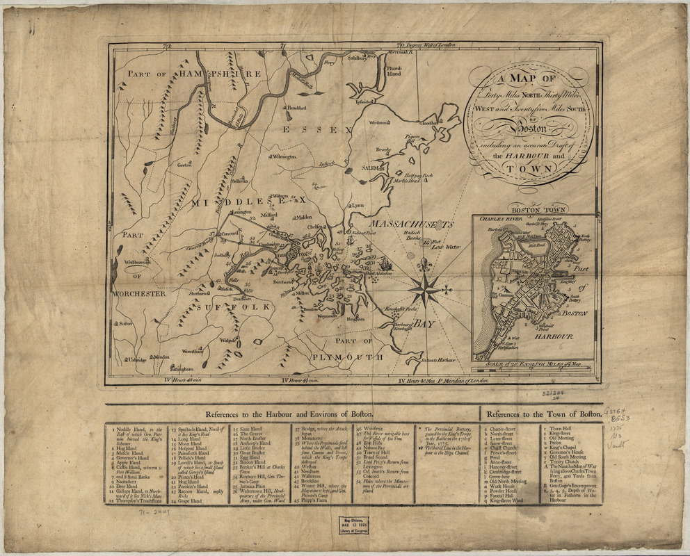
A Map of forty miles north, thirty miles west, and twentyfive miles south of Boston : including an accurate draft of the harbour and town
This map is also available in American Revolutionary Geographies Online (ARGO), a collections portal especially built for material relating to the American Revolutionary War Era. Visit ARGO to learn more about this item and explore the historical geography of North America in the late eighteenth century.
Item Information
- Title:
- A Map of forty miles north, thirty miles west, and twentyfive miles south of Boston : including an accurate draft of the harbour and town
- Date:
-
[1775?]
- Format:
-
Maps/Atlases
- Location:
- Library of Congress Geography and Map Division
- Collection (local):
-
Library of Congress Geography and Map Division
- Subjects:
-
Boston (Mass.)--History--Revolution, 1775-1783--Maps--Early works to 1800
Harbors--Massachusetts--Boston--Maps--Early works to 1800
Boston (Mass.)--Maps--Early works to 1800
Boston Region (Mass.)--Maps--Early works to 1800
- Places:
-
Boston Harbor
Suffolk (county)Boston
- Extent:
- map 30 x 43 cm.
- Terms of Use:
-
No known copyright restrictions.
This work is licensed for use under a Creative Commons Attribution Non-Commercial Share Alike License (CC BY-NC-SA).

- Scale:
-
Scale ca. 1:320,000
- Language:
-
English
- Catalog Record:
-
https://lccn.loc.gov/gm71002448
- Notes:
-
Relief shown pictorially.
Includes "References to the harbour and environs of Boston," reflecting points of general interest and military events which occured in 1775, "References to the town of Boston," and inset of "Boston Town."
- LCCN:
-
gm 71002448


