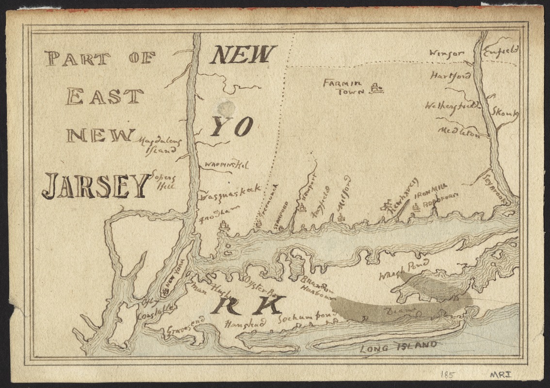
Part of east New Jarsey, New York, and Connecticut
This map is also available in American Revolutionary Geographies Online (ARGO), a collections portal especially built for material relating to the American Revolutionary War Era. Visit ARGO to learn more about this item and explore the historical geography of North America in the late eighteenth century.
Item Information
- Title:
- Part of east New Jarsey, New York, and Connecticut
- Date:
-
[1770?]
- Format:
-
Maps/Atlases
- Location:
- Phillips Academy
- Collection (local):
-
Sidney R. Knafel Map Collection at Phillips Academy, Andover MA
- Subjects:
-
Connecticut--Maps--Early works to 1800
New Jersey--Maps--Early works to 1800
New York--Maps--Early works to 1800
- Places:
-
Connecticut
New Jersey
New York
- Extent:
- 1 manuscript map : hand col. ; 13 x 19 cm.
- Terms of Use:
-
Rights status not evaluated.
Contact host institution for more information.
- Scale:
-
Scale [ca. 1:1,200,000]
- Language:
-
English
- Notes:
-
Manuscript map showing cities and towns in northeastern New Jersey, southeastern New York, and western Connecticut.
- Identifier:
-
1445


