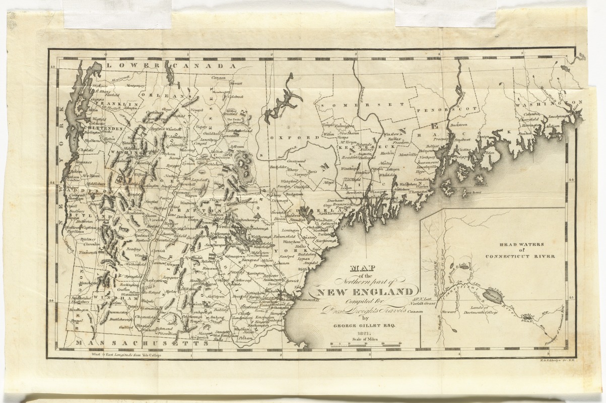
Map of the northern part of New England : compiled for Pres't. Dwight's travels
Item Information
- Title:
- Map of the northern part of New England : compiled for Pres't. Dwight's travels
- Creator:
- Gillet, George, 1771-1853
- Contributor:
- N. & S.S. Jocelyn (Firm)
- Name on Item:
-
by George Gillet Esq. ; N. & S.S. Jocelyn sc.
- Date:
-
[1821]
- Format:
-
Maps/Atlases
- Location:
- Phillips Academy
- Collection (local):
-
Sidney R. Knafel Map Collection at Phillips Academy, Andover MA
- Subjects:
-
Maine--Maps
New Hampshire--Maps
Vermont--Maps
New England--Maps
- Places:
-
Maine
New Hampshire
Vermont
New England (area)
- Extent:
- 1 map ; 19 x 35 cm.
- Terms of Use:
-
Rights status not evaluated.
Contact host institution for more information.
- Publisher:
-
[New-Haven] :
[Timothy Dwight]
- Scale:
-
Scale [ca. 1:1,400,000]
- Language:
-
English
- Notes:
-
Shows Vermont, New Hampshire, and Maine.
Relief shown by hachures.
Prime meridian: Yale College.
Inset: Head waters of Connecticut River.
From Timothy Dwight's Travels in New-England and New-York.
- Notes (date):
-
This date is inferred.
- Identifier:
-
1325


