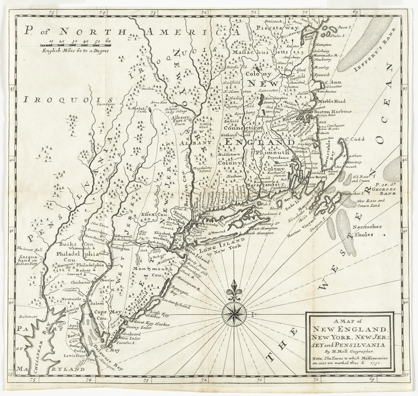
A map of New England, New York, New Jersey and Pensilvania
Item Information
- Title:
- A map of New England, New York, New Jersey and Pensilvania
- Creator:
- Moll, Herman, -1732
- Name on Item:
-
by H. Moll geographer
- Date:
-
1730
- Format:
-
Maps/Atlases
- Location:
- Phillips Academy
- Collection (local):
-
Sidney R. Knafel Map Collection at Phillips Academy, Andover MA
- Subjects:
-
New England--Maps--Early works to 1800
Middle Atlantic States--Maps--Early works to 1800
Catholic Church--Missions--United States--Maps--Early works to 1800
- Places:
-
New England (area)
Middle Atlantic (area)
- Extent:
- 1 map ; 35 x 37 cm.
- Terms of Use:
-
Rights status not evaluated.
Contact host institution for more information.
- Publisher:
-
[London? :
[s.n.]
- Scale:
-
Scale [ca. 1:1,650,000]
- Language:
-
English
- Notes:
-
Relief shown pictorially.
Shows towns to which missionaries are sent.
From David Humphreys' An historical account of the incorporated society for the propagation of the gospel in foreign parts (London : J. Downing, 1730).
- Notes (citation):
-
Phillips. Maps of America, p. 468
- Identifier:
-
1328


