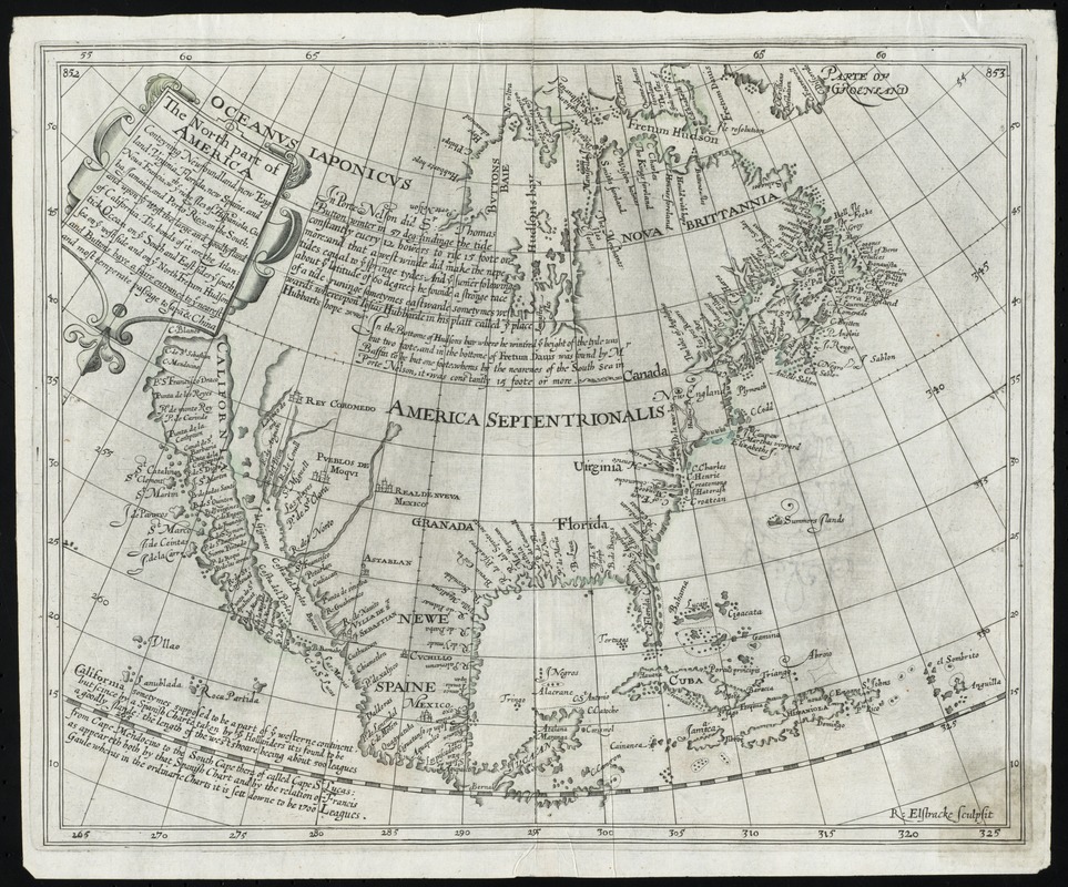
The north part of America : conteyning Newfoundland, new England, Virginia, Florida, new Spaine, and Noua Francia wth ye rich Iles of Hispaniola, Cuba, Iamaica, and Porto Rieco on the south, and upon ye west the large and goodly Iland of California ...
Item Information
- Title:
- The north part of America : conteyning Newfoundland, new England, Virginia, Florida, new Spaine, and Noua Francia wth ye rich Iles of Hispaniola, Cuba, Iamaica, and Porto Rieco on the south, and upon ye west the large and goodly Iland of California ...
- Creator:
- Elstracke, Renold, active 1590-1630
- Contributor:
- Briggs, Henry, 1561-1630
- Name on Item:
-
R. Elstracke sculpsit
- Date:
-
[1625]
- Format:
-
Maps/Atlases
- Location:
- Phillips Academy
- Collection (local):
-
Sidney R. Knafel Map Collection at Phillips Academy, Andover MA
- Subjects:
-
North America--Maps--Early works to 1800
- Places:
-
North America (area)
- Extent:
- 1 map ; 27 x 35 cm.
- Terms of Use:
-
Rights status not evaluated.
Contact host institution for more information.
- Publisher:
-
[London] :
[s.n.]
- Scale:
-
Scale [ca. 1:23,000,000]
- Language:
-
English
- Notes:
-
Prime meridian: Ferro.
Shows drainage, towns, California as an island, etc.
From Hakluytus Posthumus, or Purchas his Pilgrimes, vol. III, p. 852-3, accompanying an article by Henry Briggs.
Includes historical text.
- Notes (date):
-
This date is inferred.
- Notes (citation):
-
Wheat, C.I. Mapping the transmississippi West, v. 1, no. 38
Wagner, H.R. Cartog. NW coast, no. 295 (reprod. opp. p. 117)
- Identifier:
-
1401
- Call #:
-
Map 35.2.1625


