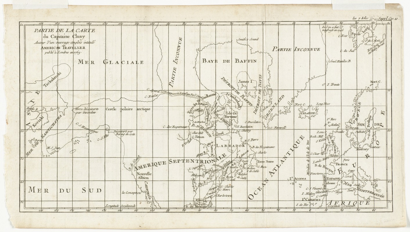
Partie de la carte du Capitaine Cluny, auteur d'un ouvrage anglois intitulé American Traveller publié à Londres en 1769
This map is also available in American Revolutionary Geographies Online (ARGO), a collections portal especially built for material relating to the American Revolutionary War Era. Visit ARGO to learn more about this item and explore the historical geography of North America in the late eighteenth century.
Item Information
- Title:
- Partie de la carte du Capitaine Cluny, auteur d'un ouvrage anglois intitulé American Traveller publié à Londres en 1769
- Creator:
- Robert de Vaugondy, Didier, 1723-1786
- Contributor:
- Clúny, Alexander
- Contributor:
- Alembert, Jean Le Rond d', 1717-1783
- Date:
-
[1772]
- Format:
-
Maps/Atlases
- Location:
- Phillips Academy
- Collection (local):
-
Sidney R. Knafel Map Collection at Phillips Academy, Andover MA
- Subjects:
-
Arctic regions--Maps--Early works to 1800
North America--Discovery and exploration--Maps--Early works to 1800
Northwest Passage--Maps--Early works to 1800
- Places:
-
Arctic (area)
North America (area)
- Extent:
- 1 map ; 22 x 40 cm.
- Terms of Use:
-
Rights status not evaluated.
Contact host institution for more information.
- Publisher:
-
[S.l.] :
[s.n.]
- Scale:
-
Scale [ca. 1:50,000,000]
- Language:
-
French
- Notes:
-
Shows North America, the Arctic, and the supposed Northwest Passage.
Prime meridian: Ferro.
In upper right: Suppl. car. 10.
From Diderot's Encyclopédie, ou, dictionnaire raisonné des sciences, des arts et des métiers.
- Notes (date):
-
This date is inferred.
- Notes (citation):
-
Encyclopédie. Suite du recueil de planches, Supplement v.5 carte 10
- Identifier:
-
1403