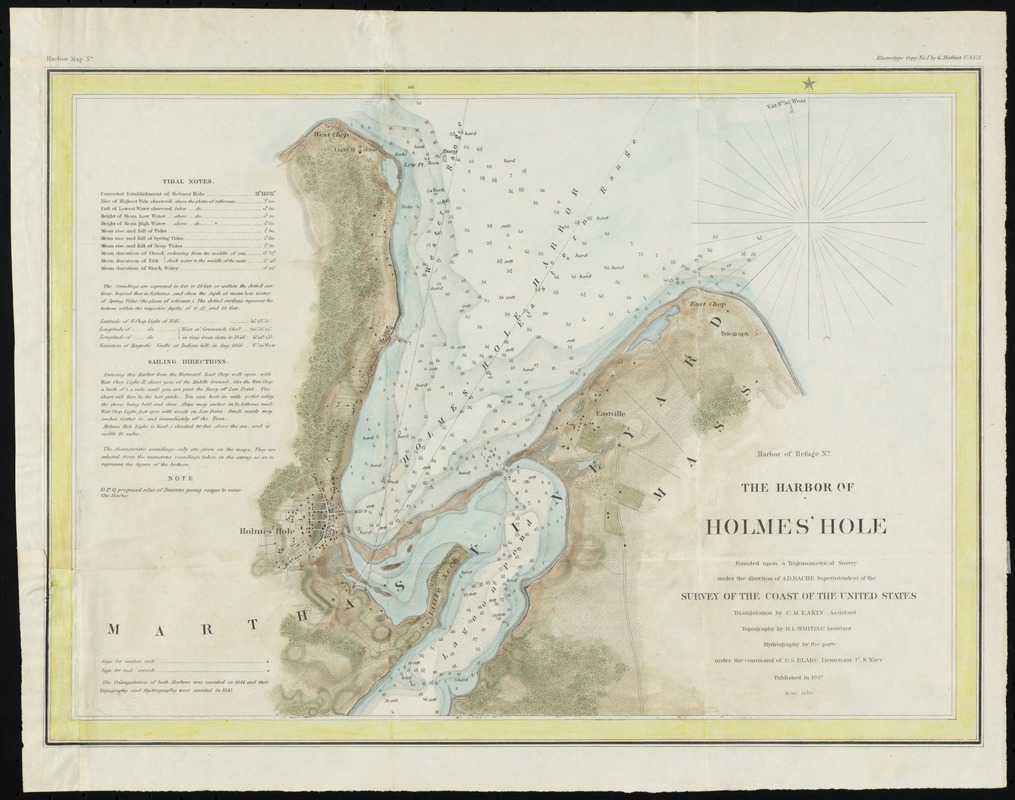
The harbor of Holmes' Hole
Item Information
- Title:
- The harbor of Holmes' Hole
- Creator:
- United States Coast Survey
- Name on Item:
-
founded upon a trigonometrical survey under the direction of A.D. Bache Superintendent of the Survey of the Coast of the United States ; triangulation by C. M. Eakin ; topography by H. L. Whiting ; hydrography by the part under the command of G.S. Blake
- Date:
-
1847
- Format:
-
Maps/Atlases
- Location:
- Phillips Academy
- Collection (local):
-
Sidney R. Knafel Map Collection at Phillips Academy, Andover MA
- Subjects:
-
Vineyard Haven (Mass)--Maps
Harbors--Massachusetts--Vineyard Haven--Maps
- Places:
-
Dukes (county)Martha's Vineyard (island)Vineyard Haven Harbor
- Extent:
- 1 map : hand col. ; 24 x 34 cm.
- Terms of Use:
-
Rights status not evaluated.
Contact host institution for more information.
- Publisher:
-
[United States] :
Survey of the Coast of the United States
- Scale:
-
Scale 1:20,000
- Language:
-
English
- Notes:
-
Relief shown by hachures. Depth shown by soundings.
At head of title: harbor of refuge no.
In upper margin: Harbor map no. -- Electrotype copy no. 1 by G. Mathiot U.S.C.S.
Includes notes.
- Identifier:
-
1396


