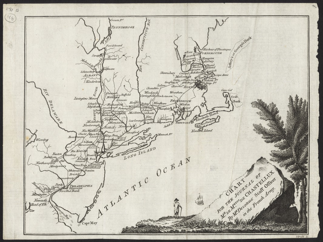
Chart for the journal of Mr. le Mquis. de Chastellux
This map is also available in American Revolutionary Geographies Online (ARGO), a collections portal especially built for material relating to the American Revolutionary War Era. Visit ARGO to learn more about this item and explore the historical geography of North America in the late eighteenth century.
Item Information
- Title:
- Chart for the journal of Mr. le Mquis. de Chastellux
- Creator:
- Dezoteux
- Name on Item:
-
by Mr. Dezoteux, staff officer in the French Army ; J. Duff sc.
- Date:
-
[1787]
- Format:
-
Maps/Atlases
- Location:
- Phillips Academy
- Collection (local):
-
Sidney R. Knafel Map Collection at Phillips Academy, Andover MA
- Subjects:
-
New England--Maps--Early works to 1800
- Places:
-
New England (area)
- Extent:
- 1 map ; 18 x 24 cm.
- Terms of Use:
-
Rights status not evaluated.
Contact host institution for more information.
- Publisher:
-
[Dublin] :
[Printed for Messrs. Colles Moncrieffe White ...]
- Scale:
-
Scale [ca. 1:3,000,000]
- Language:
-
English
- Notes:
-
From Chastellux's Travels in North-America, in the years 1780, 1781, and 1782 (Dublin : Printed for Messrs. Colles, Moncrieffe, White ..., 1787).
- Notes (date):
-
This date is inferred.
- Identifier:
-
1368


