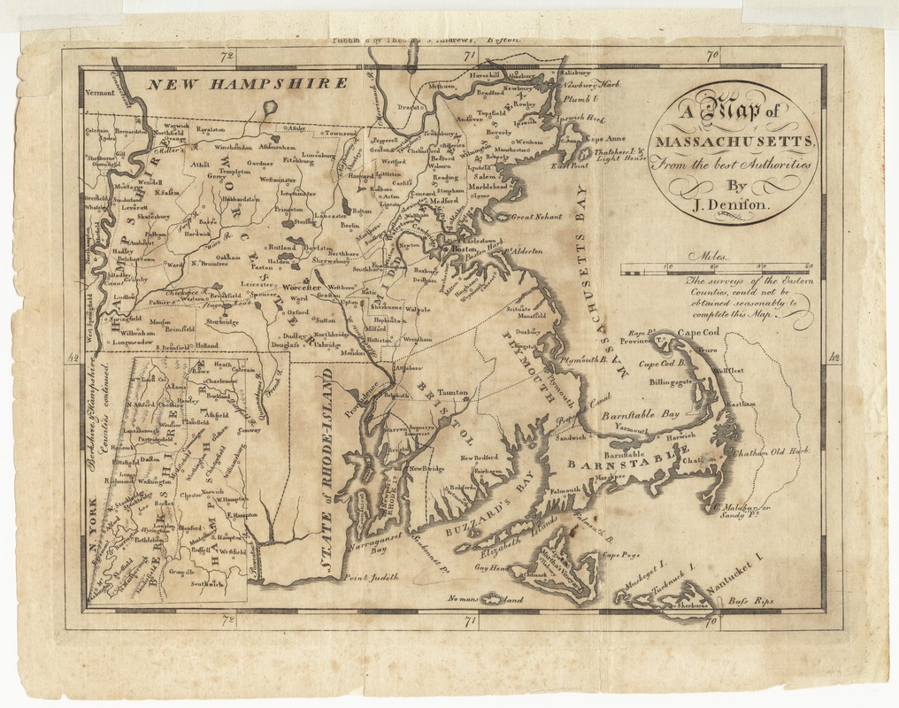
A map of Massachusetts, from the best authorities
This map is also available in American Revolutionary Geographies Online (ARGO), a collections portal especially built for material relating to the American Revolutionary War Era. Visit ARGO to learn more about this item and explore the historical geography of North America in the late eighteenth century.
Item Information
- Title:
- A map of Massachusetts, from the best authorities
- Creator:
- Denison, J.
- Contributor:
- Thomas & Andrews
- Name on Item:
-
by J. Denison ; S.H. Sc.
- Date:
-
[1796]
- Format:
-
Maps/Atlases
- Location:
- Phillips Academy
- Collection (local):
-
Sidney R. Knafel Map Collection at Phillips Academy, Andover MA
- Subjects:
-
Massachusetts--Maps--Early works to 1800
- Places:
-
Massachusetts
- Extent:
- 1 map ; 19 x 24 cm.
- Terms of Use:
-
Rights status not evaluated.
Contact host institution for more information.
- Publisher:
-
Boston :
Thomas & Andrews
- Scale:
-
Scale [ca. 1:1,070,000]
- Language:
-
English
- Notes:
-
From Jedidiah Morse's American universal geography (3rd. ed., I, opp. 393).
- Notes (date):
-
This date is inferred.
- Notes (citation):
-
Wheat & Brun. Maps and charts published in America before 1800, 218
- Identifier:
-
1375


