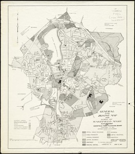
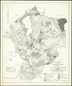
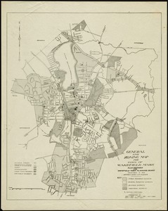
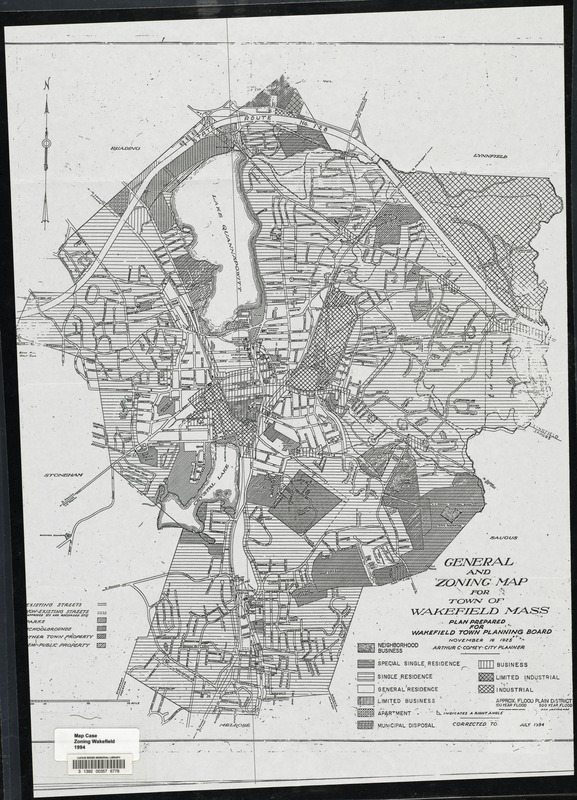
General and zoning map for town of Wakefield Mass.
Item Information
- Title:
- General and zoning map for town of Wakefield Mass.
- Creator:
- Comey, Arthur C. (Arthur Coleman), 1886-1954
- Name on Item:
-
plan prepared for Wakefield Town Planning Board ; Nov. 16, 1925, Arthur C. Comey, city planner
- Date:
-
1994
- Format:
-
Maps/Atlases
- Location:
- Lucius Beebe Memorial Library
- Collection (local):
-
Lucius Beebe Memorial Library Historic Maps
- Subjects:
-
Zoning
- Places:
-
Middlesex (county)Wakefield
- Extent:
- 1 map : b&w ; 61 x 43 cm.
- Terms of Use:
-
No known copyright restrictions.
No known restrictions on use.
- Publisher:
-
Wakefield, MA :
Planning Board
- Edition:
- Corr. to July 1994
- Scale:
-
Scale [ca. 1:12,000]
- Language:
-
English
- Notes:
-
Map depicts entire town of Wakefield as of 1994, showing zoning districts, existing and proposed streets, parks, schoolgrounds, other town property, and semi-public property.
- Call #:
-
Local History Map Case Zoning Wakefield 1994
- Barcode:
-
31392003576778