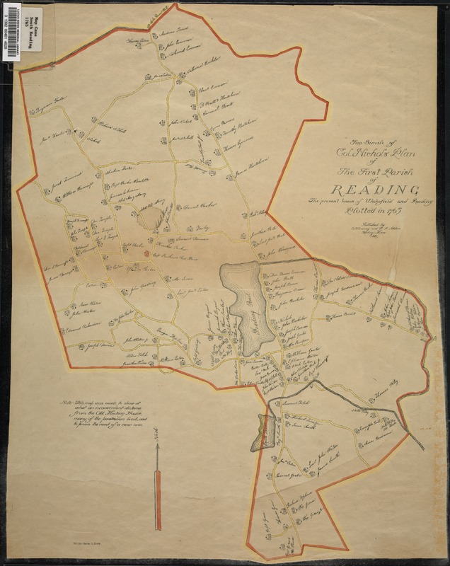
Facsimile of Col. Nichols' plan of the First Parish of Reading, the present towns of Wakefield and Reading, plotted in 1765
Item Information
- Title:
- Facsimile of Col. Nichols' plan of the First Parish of Reading, the present towns of Wakefield and Reading, plotted in 1765
- Date:
-
1889
- Format:
-
Maps/Atlases
- Location:
- Lucius Beebe Memorial Library
- Collection (local):
-
Lucius Beebe Memorial Library Historic Maps
- Places:
-
Middlesex (county)Wakefield
- Extent:
- 1 map : b&w, ink and pencil on paper, mounted on linen, some hand coloring ; 49 x 38 cm.
- Terms of Use:
-
No known copyright restrictions.
No known restrictions on use.
- Publisher:
-
Reading, Mass. :
E.H. Gowering and W.P. Adden
- Scale:
-
Scale [ca. 1:21,120]
- Language:
-
English
- Notes:
-
Map depicts Wakefield and Reading around 1865, showing town boundaries, roads, and houses with property owners' names.
"This map was made to show at what an inconvenient distance from the Old Meeting House many of the parishioners lived, and to prove the need of a new one" -- text from map.
- Call #:
-
Local History Map Case South Reading 1765
- Barcode:
-
31392004614628