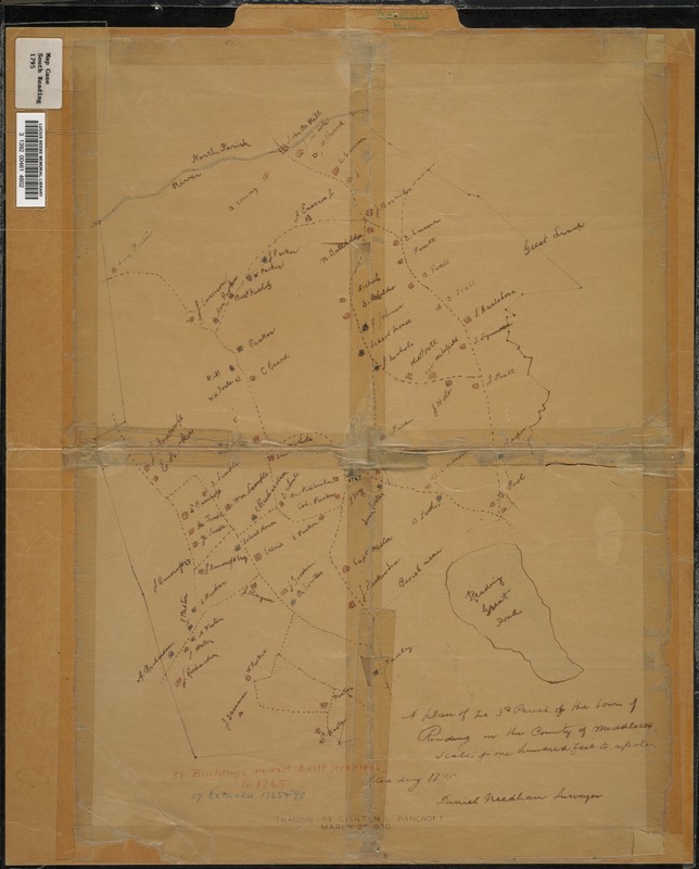
A plan of the 3rd Parish of the Town of Reading in the County of Middlesex
Item Information
- Title:
- A plan of the 3rd Parish of the Town of Reading in the County of Middlesex
- Surveyor:
- Needham, Daniel
- Contributor:
- Bancroft, Clinton L.
- Name on Item:
-
Tracing by Clinton L. Bancroft
- Date:
-
1930
- Format:
-
Maps/Atlases
- Location:
- Lucius Beebe Memorial Library
- Collection (local):
-
Lucius Beebe Memorial Library Historic Maps
- Places:
-
Middlesex (county)Wakefield
Middlesex (county)North Reading
Middlesex (county)Reading
- Extent:
- 1 map ; 45 x 32 cm.
- Terms of Use:
-
No known copyright restrictions.
No known restrictions on use.
- Publisher:
-
Wakefield, Mass. :
Clinton L. Bancroft
- Scale:
-
Scale ca. [1:21,120]
- Language:
-
English
- Notes:
-
Map depicts Reading from the Ipswich River south to the Great Reading Pond (i.e., Lake Quannapowitt) in 1795, showing roads, houses, and property owners. It is a 1930 tracing of an original by Daniel Needham, surveyor. A note reads "Scale of one hundred feet to a pole"
- Notes (date):
-
Originally published 1795.
- Call #:
-
Local History Map Case South Reading 1795
- Barcode:
-
31392004614602


