A new and complete map of the West Indies : comprehending all the coasts and islands known by that name
This map is also available in American Revolutionary Geographies Online (ARGO), a collections portal especially built for material relating to the American Revolutionary War Era. Visit ARGO to learn more about this item and explore the historical geography of North America in the late eighteenth century.
Item Information
- Title:
- A new and complete map of the West Indies : comprehending all the coasts and islands known by that name
- Creator:
- Anville, Jean Baptiste Bourguignon d', 1697-1782
- Name on Item:
-
by Monsr. Danville, with several emendations and improvements.
- Date:
-
1794
- Format:
-
Maps/Atlases
- Location:
-
Boston Public Library
Norman B. Leventhal Map Center - Collection (local):
-
Norman B. Leventhal Map Center Collection
- Subjects:
-
West Indies--Maps--Early works to 1800
- Places:
-
West Indies
- Extent:
- 1 map : hand col. ; 54 x 89 cm.
- Terms of Use:
-
No known copyright restrictions.
No known restrictions on use.
- Publisher:
-
London :
Laurie & Whittle
- Scale:
-
Scale [ca. 1:6,500,000]
- Language:
-
English
- Notes:
-
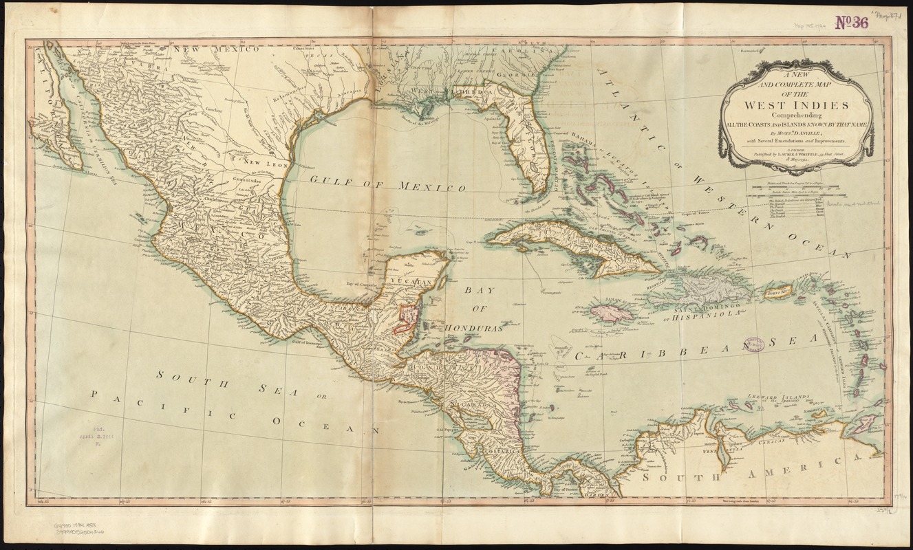
Covers Mexico, Central America, the southern U.S., and northern South America.
Relief shown pictorially.
"12th. May, 1794."
Prime meridian: London.
Hand colored.
Title in decorative cartouche.
Based on the work of the French geographer Jean Baptiste Bourguignon d'Anville, this map of the West Indies was published by the prolific late-18th-century British firm of Laurie and Whittle. The map encompasses a region that modern geographers refer to as Middle America, the lands and islands bordering the Gulf of Mexico and the Caribbean Sea. In presenting the European colonial rivalries for these coveted lands, the map maker used six colors to symbolize those areas under the control of Spain, England, and France, the major players in this colonial arena, as well as the lesser participants -- the Netherlands, Denmark, and Sweden. While most of the mainland (Florida, Mexico, Central America, and northern South America) was colored yellow indicating Spanish control, British possessions, shown in red, include two areas on the Central American mainland as well as Jamaica and most of the Lesser Antilles. Meanwhile France's possessions, shown in blue, have been reduced to Hispaniola, Guadaluope, and Martinique following France's defeat in the French and Indian War.
Featured in the Faces & Places Exhibit, Kravis Center, Palm Beach, FL, since 2005. MB (BRL)
Cataloging, conservation, and digitization made possible in part by The National Endowment for the Humanities: Exploring the human endeavor.
- Identifier:
-
06_01_010504
- Call #:
-
G4900 1794 .A58
- Barcode:
-
39999052509260
![[Alleen de Caribische Eilanden, vervat in 't groot]](https://bpldcassets.blob.core.windows.net/derivatives/images/commonwealth:st74cw59p/image_thumbnail_300.jpg)


