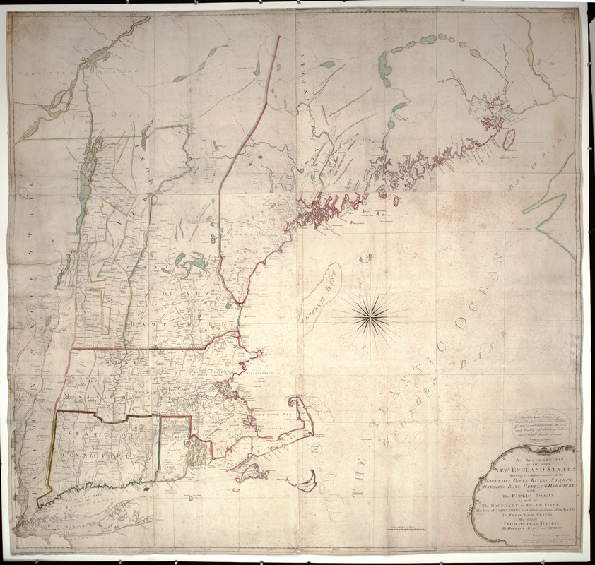
An accurate map of the four New England states : shewing in a distinct manner all the mountains, forts, rivers, swamps, marshes, bays, creeks & harbours with the public roads as well as the boundary or state lines, the several townships and other divisions of the land in these four states
This map is also available in American Revolutionary Geographies Online (ARGO), a collections portal especially built for material relating to the American Revolutionary War Era. Visit ARGO to learn more about this item and explore the historical geography of North America in the late eighteenth century.
Item Information
- Title:
- An accurate map of the four New England states : shewing in a distinct manner all the mountains, forts, rivers, swamps, marshes, bays, creeks & harbours with the public roads as well as the boundary or state lines, the several townships and other divisions of the land in these four states
- Description:
-
This map was the first American wall map, and among the most important early maps published in the United States. Despite its rudimentary and rustic appearance this impressive wall map was the earliest accurate survey of the New England region published in the new nation. Due to a chronic lack of trained surveyors, engravers and printers in post-Revolutionary War America, very few maps of any kind were published before 1790. Utilizing information from several earlier maps and coastal charts published in England, this map of the four New England states -- Massachusetts (including Maine counties), New Hampshire (including Vermont counties), Rhode Island, and Connecticut -- added substantial new information in the northern portions of the map, particularly for the New Hampshire townships and Maine's coastal area.
- Creator:
- Norman, John, 1748?-1817
- Contributor:
- Coles, John
- Name on Item:
-
the whole from actual surveys by Holland, Evans and others ; published and sold by Norman & Coles
- Date:
-
1785
- Format:
-
Maps/Atlases
- Location:
- Private Collection
- Collection (local):
-
Mapping Boston Collection
- Subjects:
-
New England--Maps--Early works to 1800
- Places:
-
New England (area)
- Extent:
- 1 map : col. ; 157 x 205 cm.
- Terms of Use:
-
No known copyright restrictions.
This work is licensed for use under a Creative Commons Attribution Non-Commercial Share Alike License (CC BY-NC-SA).

- Publisher:
-
Boston :
Norman and Coles
- Scale:
-
Scale not given
- Language:
-
English
- Notes:
-
Relief shown pictorially.
- Identifier:
-
05_04_000070
- Barcode:
-
39999052507553


