A new mapp of New England and Annapolis and the countrys adjacent
Item Information
- Title:
- A new mapp of New England and Annapolis and the countrys adjacent
- Description:
-
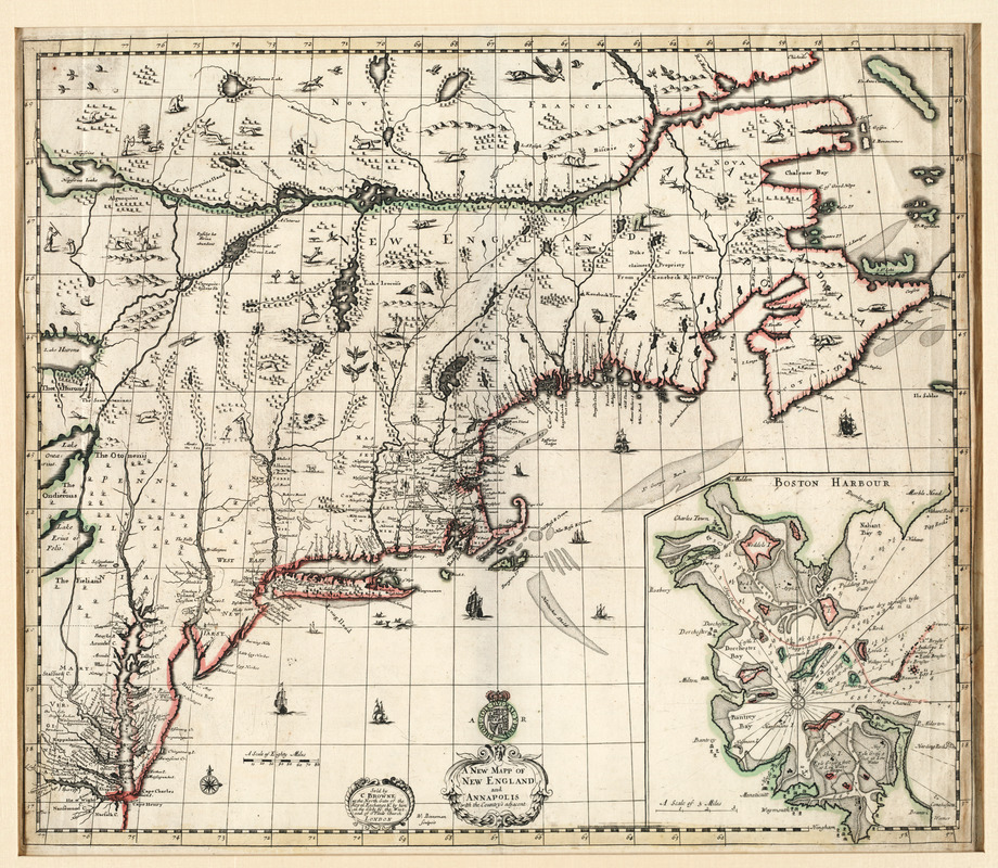
As an example of early English mapping of the British Colonies in North America, Browne's map shows the northeastern part of the continent from the St. Lawrence River to the Chesapeake Bay. Interestingly, the most carefully drawn region is New England, with roads delineated from Boston to Springfield, Hartford, and New London. Browne, a London map seller, reissued this third and final edition of the map with a new title and an inset of Boston Harbor, the earliest known detailed chart of the area. Two previous editions of this map published by Richard Daniel displayed a Carolina coast inset instead of Boston Harbor. Browne was known to have bought plates from other map dealers and then alter them. His name and workplace appear on this plate in place of the original map dealer.
- Creator:
- Browne, Christopher, fl. 1684-1712
- Contributor:
- Binneman, Walter
- Name on Item:
-
sold by C. Browne ... ; W. Binneman sculpsit.
- Date:
-
1690
- Format:
-
Maps/Atlases
- Location:
- Private Collection
- Collection (local):
-
Mapping Boston Collection
- Subjects:
-
Middle Atlantic States--Maps--Early works to 1800
Annapolis (Md.)--Maps--Early works to 1800
New England--Maps--Early works to 1800
- Places:
-
New England (area)
Middle Atlantic (area)
Anne Arundel (county)Annapolis
- Extent:
- 1 map : col. ; 50 x 60 cm.
- Terms of Use:
-
No known copyright restrictions.
This work is licensed for use under a Creative Commons Attribution Non-Commercial Share Alike License (CC BY-NC-SA).

- Publisher:
-
London :
[s.n.]
- Scale:
-
Scale not given
- Language:
-
English
- Notes:
-
Relief shown pictorially.
Depths shown by soundings.
Includes inset of Boston Harbor.
- Identifier:
-
05_04_000053
- Barcode:
-
39999052507512


