Tierra nueua
Item Information
- Title:
- Tierra nueua
- Title (alt.):
-
Tierra nveva
Tierra nueva
- Description:
-
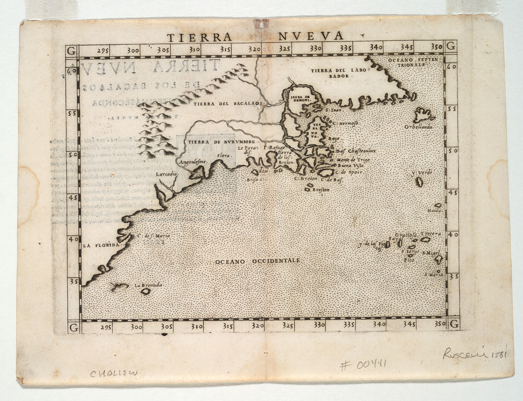
Ruscelli's map of northeastern North America appeared in his 1561 edition of Claudius Ptolemy's "Geographia". The map was based on a smaller 1548 map by Giacomo Gastaldi, who took much of his information from the explorer Giovanni di Verrazano. Gastaldi's map is recognized as the first regional map of the northeast coast. Although difficult to reconcile with modern geography, note the place name 'Angoulesme,' which was Verrazano's name for New York Harbor and 'Nurumberg' (Norumbega), the name for present day New England. The fictitious inland waterway, which assumed that the Hudson and St. Lawrence were connected upriver, was adapted from a 1556 map of New England and New France by Giovanni Battista Ramusio.
- Creator:
- Ruscelli, Girolamo, d. ca. 1565
- Contributor:
- Gastaldi, Giacomo, ca. 1500-ca. 1565
- Contributor:
- Sanuto, Giulio, 1540-1580
- Contributor:
- Sanuto, Livio, 1520-1576
- Name on Item:
-
G. Ruscelli
- Date:
-
[1561]
- Format:
-
Maps/Atlases
- Location:
- Private Collection
- Collection (local):
-
Mapping Boston Collection
- Subjects:
-
North America--Maps--Early works to 1800
- Places:
-
North America (area)
- Extent:
- 1 map ; 23 x 31 cm.
- Terms of Use:
-
No known copyright restrictions.
This work is licensed for use under a Creative Commons Attribution Non-Commercial Share Alike License (CC BY-NC-SA).

- Publisher:
-
Venice :
Valgrisi?
- Scale:
-
Scale [ca. 1:21,000,000]
- Language:
-
Italian
- Notes:
-
Relief shown pictorially.
Attributed to Giacomo Gastaldi, with engraving by Giulio and Livio Sanuto--Burden.
First state, based on plate mark that runs off top of page--Burden.
Appears in Ruscelli's edition of Ptolemy's Geografia di Claudio Tolomeo Alessandrino. 1561.
Text on verso.
On verso: XXXII Ii.
- Notes (date):
-
This date is inferred.
- Identifier:
-
05_04_000049
- Barcode:
-
39999052507496


