Pas caarte van Nieu Nederlandt
Item Information
- Title:
- Pas caarte van Nieu Nederlandt
- Title (alt.):
-
Pascaarte van Nieu Nederlandt
- Description:
-
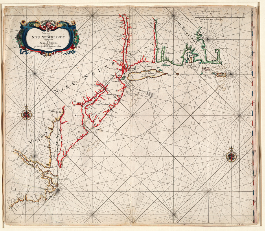
A rare map published in Colom's "Zee Atlas" is recognized as one of the first navigational charts of New Netherlands. The chart covers the North American coast line from Cape Hatteras on the southwest to Cape Cod on the northeast, encompassing the Dutch settlements on the Delaware and Hudson Rivers. Interestingly, the chart also identifies English settlements in the Chesapeake Bay area and New England including the fledgling communities of Salem, Boston, and Plymouth. Although Colom's "Zee Atlas" was only issued in a few editions, this chart served as a precedent for other Dutch maritime chart makers including Hendrick Doncker, Pieter Goos, Joannes van Loon, Arent Roggeveen, and Jacob Colom, Arnold's father. The Coloms were two of the first Dutch publishers to produce large-format world maritime atlases.
- Creator:
- Colom, Arnold, 1624-1668
- Name on Item:
-
uytgegeven door Arnold Colom
- Date:
-
1656
- Format:
-
Maps/Atlases
- Location:
- Private Collection
- Collection (local):
-
Mapping Boston Collection
- Subjects:
-
Atlantic Coast (New England)--Maps--Early works to 1800
Atlantic Coast (Middle Atlantic States)--Maps--Early works to 1800
- Places:
-
New England (area)
Middle Atlantic (area)
- Extent:
- 1 map : col. ; 57 x 65 cm.
- Terms of Use:
-
No known copyright restrictions.
This work is licensed for use under a Creative Commons Attribution Non-Commercial Share Alike License (CC BY-NC-SA).

- Publisher:
-
Amsterdam :
[s.n.]
- Scale:
-
Scale not given
- Language:
-
Dutch
- Notes:
-
Depths shown by soundings.
Original outline color.
Appears in Colom's Zee-atlas, ofte Water-wereldt. [1656?].
- Identifier:
-
05_04_000051
- Barcode:
-
39999052509450


