Boston
Item Information
- Title:
- Boston
- Description:
-
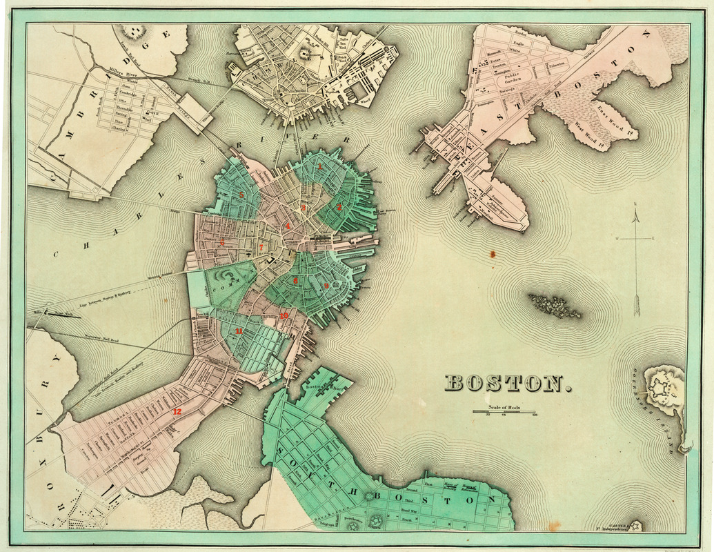
Boston's transformation and growth from a colonial port city originally confined to the physical limitations of the Shawmut Peninsula are outlined on this map. Starting in the 1790s, bridges were built to connect Boston to the growing urban settlements of Cambridge, Charlestown, South Boston and South Bay. Bostonians began to increase the peninsula's useable land areas by extending and filling in between wharves, and reclaiming the Mill Pond and tidal flats, along the peninsula's narrow neck. During the 1830s with the introduction of railroads into the New England area, Boston developed a viable transportation alternative to ocean and coastal shipping. The map was engraved by G.W. Boynton, Boston's leading engraver during the mid-1800s.
- Creator:
- Bradford, T. G. (Thomas Gamaliel), 1802-1887
- Contributor:
- Boynton, George W., d. 1884
- Contributor:
- Weeks, Jordan & Company
- Name on Item:
-
engraved by G.W. Boynton
- Date:
-
1838
- Format:
-
Maps/Atlases
- Location:
- Private Collection
- Collection (local):
-
Mapping Boston Collection
- Subjects:
-
Fortification--Massachusetts--Boston--Maps
Boston (Mass.)--Maps
- Places:
-
MassachusettsSuffolk (county)Boston
- Extent:
- 1 map : col. ; 38 x 42 cm.
- Terms of Use:
-
No known copyright restrictions.
This work is licensed for use under a Creative Commons Attribution Non-Commercial Share Alike License (CC BY-NC-SA).

- Publisher:
-
[S.l] :
[s.n.]
- Scale:
-
Scale [ca. 1:19,500]
- Language:
-
English
- Notes:
-
Relief shown by hachures.
Appears in T.G. Bradford's Illustrated atlas, geographical, statistical, and historical of the United States, and the adjacent countries. Boston. 1838.
- Identifier:
-
05_04_000075
- Barcode:
-
39999052507579


