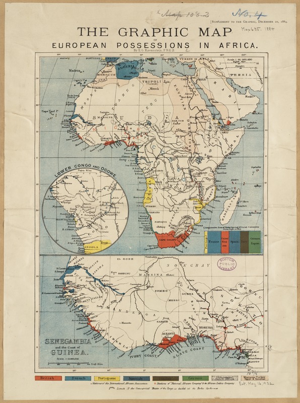
The graphic map of European possessions in Africa
Item Information
- Title:
- The graphic map of European possessions in Africa
- Title (alt.):
-
European possessions in Africa
- Creator:
- Ravenstein, Ernst Georg, 1834-1913
- Name on Item:
-
by E.G. Ravenstein.
- Date:
-
[1884]
- Format:
-
Maps/Atlases
- Location:
-
Boston Public Library
Norman B. Leventhal Map Center - Collection (local):
-
Norman B. Leventhal Map Center Collection
- Subjects:
-
Africa--Maps
Africa--Colonization--History--19th century--Maps
Europe--Colonies--Africa--Maps
- Places:
-
Africa
Africa
- Extent:
- 1 map : col. ; 21 x 24 cm., on sheet 41 x 31 cm.
- Terms of Use:
-
No known copyright restrictions.
No known restrictions on use.
- Publisher:
-
London :
Graphic
- Scale:
-
Scale 1:40,000,000
- Language:
-
English
- Notes:
-
Includes inset map "Lower Congo and Ogowe" and ancillary map "Senegambia and the coast of Guinea."
"Supplement to the Graphic, December 10, 1884."
- Notes (date):
-
This date is inferred.
- Identifier:
-
06_01_000969
- Call #:
-
G8200 1884 .R39
- Barcode:
-
39999052508775


