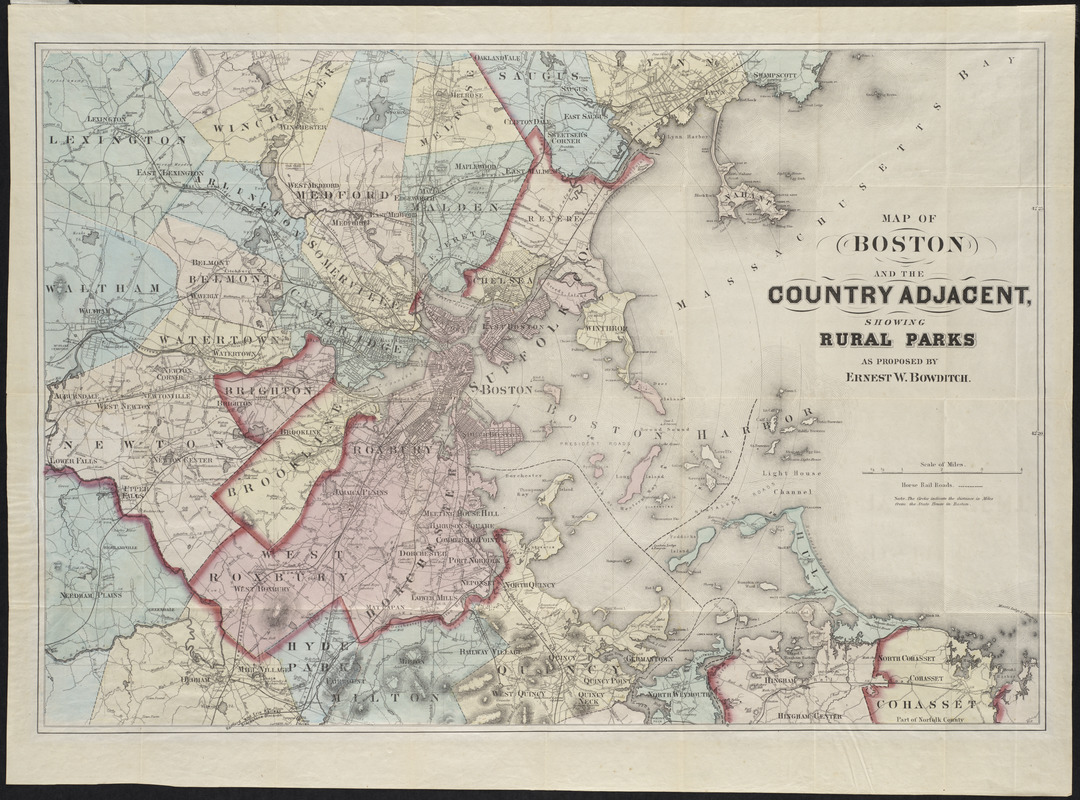
Map of Boston and the country adjacent, showing rural parks
Item Information
- Title:
- Map of Boston and the country adjacent, showing rural parks
- Creator:
- Bowditch, Ernest W.
- Name on Item:
-
as proposed by Ernest W. Bowditch
- Date:
-
[ca. 1874]
- Format:
-
Maps/Atlases
- Location:
-
Boston Public Library
Norman B. Leventhal Map Center - Collection (local):
-
Norman B. Leventhal Map Center Collection
- Subjects:
-
Parks--Massachusetts--Boston--Maps
Boston (Mass.)--Maps
- Places:
-
Suffolk (county)Boston
- Extent:
- 1 map : hand col. ; 44 x 64 cm.
- Terms of Use:
-
No known copyright restrictions.
No known restrictions on use.
- Publisher:
-
Boston? :
s.n.
- Scale:
-
Scale [ca. 1:63,360]
- Language:
-
English
- Notes:
-
Shows railroads, roads, buildings, and radial distances from State House.
Relief shown by hachures.
Copy 2:
- Identifier:
-
06_01_001250
- Call #:
-
G3764.B6G52 1874 .B6
- Barcode:
-
39999085930483


