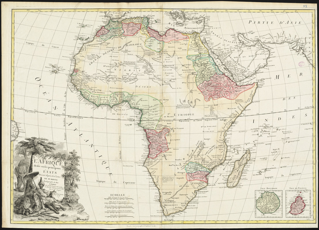
L'Afrique divisée en ses principaux états
Item Information
- Title:
- L'Afrique divisée en ses principaux états
- Creator:
- Bonne, Rigobert, 1727-1794
- Cartographer:
- Bonne, Rigobert, 1727-1794
- Publisher:
- Lattré, Jean
- Name on Item:
-
dressée d'après les cartes de Mr. Bonne, Hydrographe du Roi.
- Date:
-
1778
- Format:
-
Maps/Atlases
- Location:
-
Boston Public Library
Norman B. Leventhal Map Center - Collection (local):
-
Norman B. Leventhal Map Center Collection
- Subjects:
-
Africa--Maps
- Places:
-
Africa
Africa
- Extent:
- 1 map : hand colored ; 69 x 99 cm
- Terms of Use:
-
No known copyright restrictions.
No known restrictions on use.
- Publisher:
-
Paris :
Chez Lattre
- Scale:
-
Scale approximately 1:12,200,000
- Language:
-
French
- Notes:
-
Relief shown pictorially.
Prime meridian: Ferro.
Insets: Isle Bourbon -- Isle de France.
Conservation of this piece was funded by Alan and Sherry Leventhal in memory of his father, Norman B. Leventhal whose vision to create this Map Center will inspire generations to come.
Map 28 in a composite atlas with the title "Atlas of the world."
- Identifier:
-
06_01_014670
- Call #:
-
G1015 .A85 1783
- Barcode:
-
30000004730341


