Historical map of Watertown, 1630-1930
Item Information
- Title:
- Historical map of Watertown, 1630-1930
- Description:
-
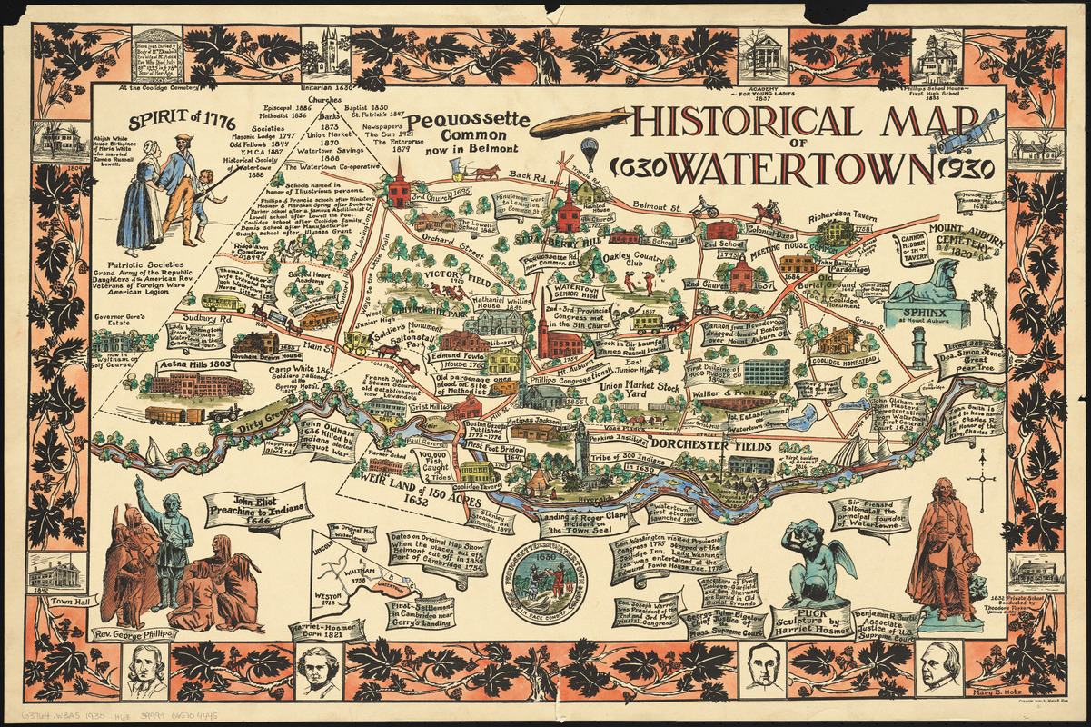
Mary Hotz designed this map as a high school student in 1930, for a poster contest celebrating the 300th anniversary of Watertown, Massachusetts. Her map of historical Watertown, complete with Native Americans, houses, churches, arsenals, courthouses, taverns, mills, schools and statues was the winning entry. Hotz combined recent and past history in this colorful and detailed map, which she shared with local community clubs, and President Calvin Coolidge, who had family ties to the town. She eventually attended art school in Boston, but never practiced professionally; however, her map appeared for years in official buildings and private residences throughout Watertown.
- Creator:
- Hotz, Mary B.
- Cartographer:
- Hotz, Mary B.
- Name on Item:
-
Mary B. Hotz
- Date:
-
1930
- Format:
-
Maps/Atlases
- Location:
-
Boston Public Library
Norman B. Leventhal Map Center - Collection (local):
-
Norman B. Leventhal Map Center Collection
- Subjects:
-
Watertown (Mass.)--Maps
Pictorial maps
- Places:
-
Middlesex (county)Watertown
- Extent:
- 1 map : color ; 41 x 67 cm, on sheet 53 x 79 cm
- Terms of Use:
-
No known copyright restrictions.
No known restrictions on use.
- Publisher:
-
[Place of publication not identified] :
[publisher not identified]
- Scale:
-
Scale approximately 1:9,500
- Language:
-
English
- Notes:
-
Includes illustrations, notes and decorative border.
Inset: The original map of Watertown.
Several other printings of this map were issued, with color overprint and in various scales.
- Notes (exhibitions):
-
Exhibited: "Women in Cartography: Five Centuries of Accomplishments" organized by the Norman B. Leventhal Map Center at the Boston Public Library, 2015-2016.
- Identifier:
-
06_01_014645
- Call #:
-
G3764.W3A5 1930 .H68
- Barcode:
-
39999065704445