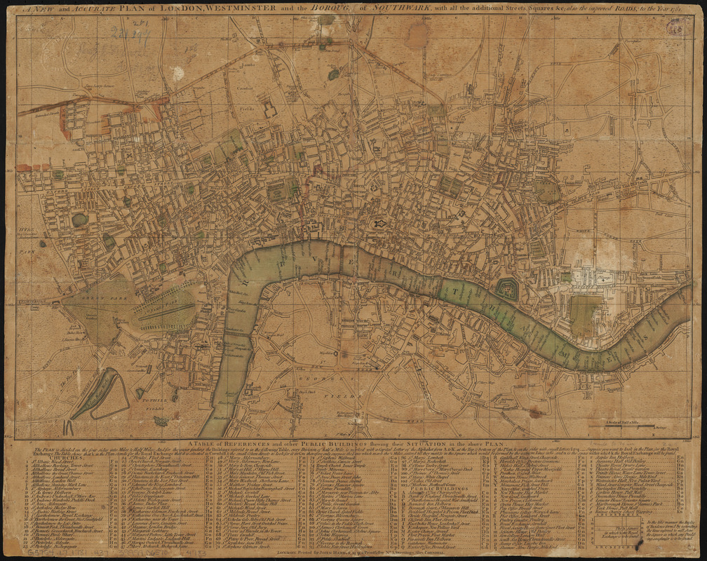
A new and accurate plan of London, Westminster and the Borough of Southwark, with all the additional streets, squares, &c : also the improved roads, to the year 1781
Item Information
- Title:
- A new and accurate plan of London, Westminster and the Borough of Southwark, with all the additional streets, squares, &c : also the improved roads, to the year 1781
- Creator:
- Harris, John, approximately 1740-1812
- Date:
-
1781
- Format:
-
Maps/Atlases
- Location:
-
Boston Public Library
Norman B. Leventhal Map Center - Collection (local):
-
Norman B. Leventhal Map Center Collection
- Subjects:
-
London (England)--Maps
- Places:
-
EnglandLondon
- Extent:
- 1 map : hand colored ; 32 x 52 cm
- Terms of Use:
-
No known copyright restrictions.
No known restrictions on use.
- Publisher:
-
London :
Printed for John Harris, map & printseller no. 3, Sweetings Alley, Cornhill
- Scale:
-
Scale approximately 1:16,250
- Language:
-
English
- Notes:
-
Includes table of references and other public buildings.
Variant of number 170 in Howgego's Printed maps of London (2nd edition).
Conservation of this piece was funded by Judith and Robert Melzer in memory of Norman B. Leventhal.
- Identifier:
-
06_01_014610
- Call #:
-
G5754.L7 1781 .H37
- Barcode:
-
39999065704783


