Geographisches lottospiel, ganz neue vermehrte u. verbesserte auflage : durch welches sich die kinder spielend neit den hauptpunkten der geographie bekannt machen, die einwohnerzahl aller lander der welt, all namen der haupt u residenzstadte, die lage derselben, die namen u geburtstage der regenten ein-pragen konnen [cover]
Item Information
- Title:
- Geographisches lottospiel, ganz neue vermehrte u. verbesserte auflage : durch welches sich die kinder spielend neit den hauptpunkten der geographie bekannt machen, die einwohnerzahl aller lander der welt, all namen der haupt u residenzstadte, die lage derselben, die namen u geburtstage der regenten ein-pragen konnen [cover]
- Description:
-
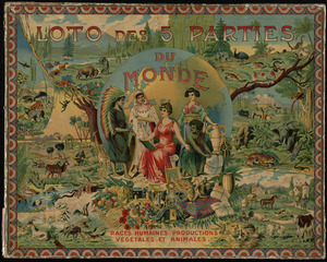
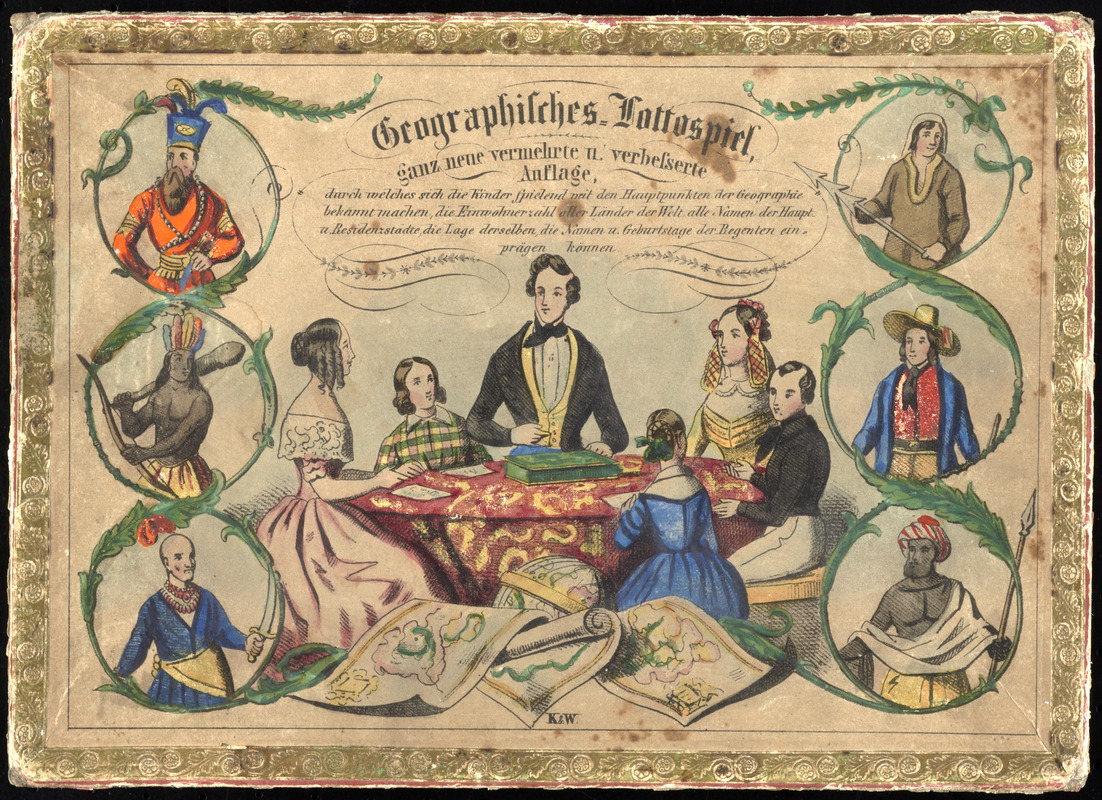
Games designed to teach geography were prevalent in Europe. This 19th century German version depicts a family playing the game on the cover, surrounded by peoples of the world. The object of this “lotto” game, which is similar to a modern-day Bingo game, was to fill each board, representing geographic locations, by collecting tiles or cards corresponding to those locales. These games not only imparted geographical knowledge, but also taught social, cultural, and natural science.
- Date:
-
[1835?–1855?]
- Format:
-
Maps/Atlases
- Location:
-
Boston Public Library
Norman B. Leventhal Map Center - Collection (local):
-
Norman B. Leventhal Map Center Collection
- Subjects:
-
Geographical recreations
Capitals (Cities)--Games
Bingo
- Extent:
- 1 game (16 cards, 90 calling cards) ; in box 17 x 24 x 3 cm.
- Terms of Use:
-
No known copyright restrictions.
No known restrictions on use.
- Publisher:
-
Germany? :
K. & W.?
- Language:
-
German
- Notes:
-
A game similar to bingo in which players match drawn countries against capitals printed on their cards, with the goal of forming a line on their card. Includes directions, cardboard game box, 16 cards (9 x 22 cm.), and 90 calling cards (3 x 3 cm.). Cards consist of an engraved vignette and 30 squares, 20 of which (in 4 rows of 5) contain the names of capitals and relevant statistics. Calling cards are printed with the name of a country and relevant statistics.
Title and publisher from box.
Cover of box shows a family around the game, 3 maps and a globe, and 6 illustrations of men from various cultures.
Boston Public Library lacking 3 calling cards: 2 Altenburg -- 12 Lippe-Schaumburg -- 25 Cleve berg.
- Notes (exhibitions):
-
Exhibited: "Back to School: Geography in the Classroom" organized by the Norman B. Leventhal Map Center at the Boston Public Library, 2014-2015.
- Identifier:
-
06_01_012147
- Call #:
-
GV1485 .G46 1855
- Barcode:
-
39999065671859