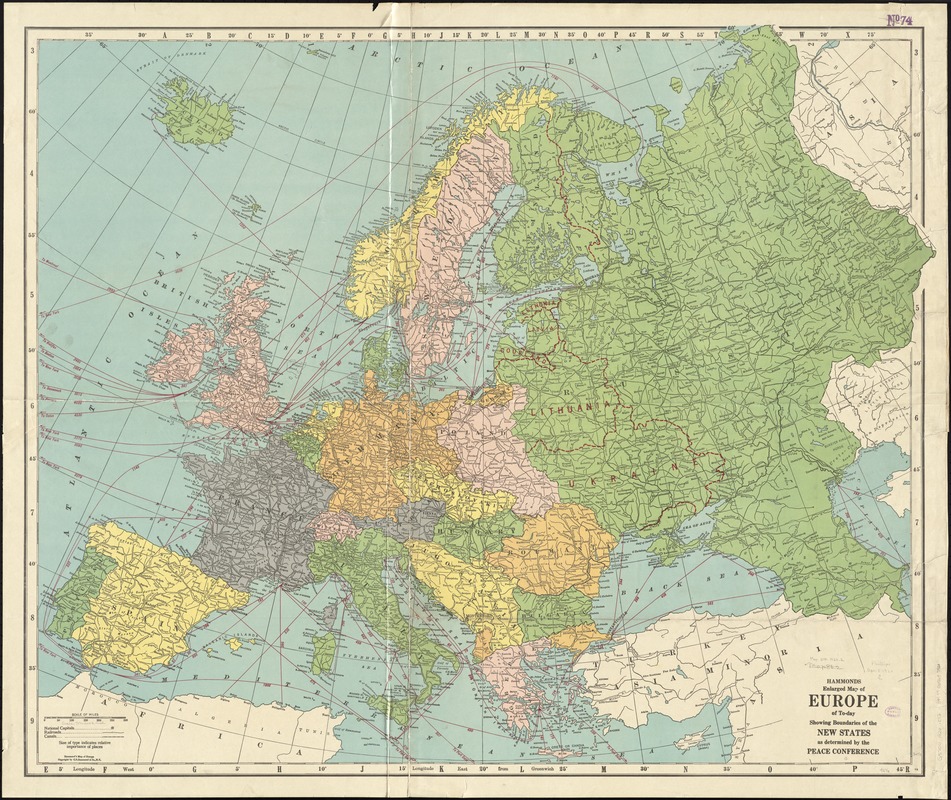
Hammond's enlarged map of Europe of to-day showing boundaries of the new states as determined by the peace conference
Item Information
- Title:
- Hammond's enlarged map of Europe of to-day showing boundaries of the new states as determined by the peace conference
- Title (alt.):
-
Hammond's map of Europe
- Creator:
- C.S. Hammond & Company
- Date:
-
[1920]
- Format:
-
Maps/Atlases
- Location:
-
Boston Public Library
Norman B. Leventhal Map Center - Collection (local):
-
Norman B. Leventhal Map Center Collection
- Subjects:
-
Europe--Maps
- Places:
-
Europe
Europe
- Extent:
- 1 map : color ; 89 x 110 cm
- Terms of Use:
-
No known copyright restrictions.
No known restrictions on use.
- Publisher:
-
N.Y. :
C.S. Hammond & Co.,
- Scale:
-
Scale approximately 1:4,860,000
- Language:
-
English
- Notes:
-
Date of publication estimated from date of acquisition.
- Notes (date):
-
This date is inferred.
- Identifier:
-
06_01_012274
- Call #:
-
G5700 1920 .C72
- Barcode:
-
39999065697920


