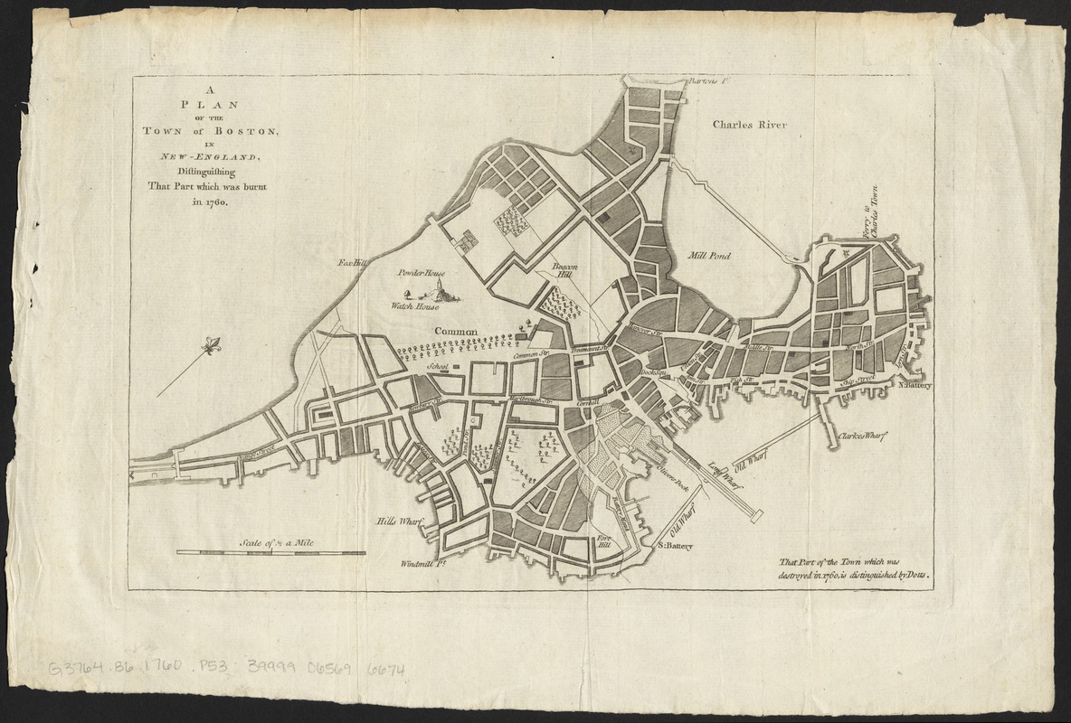
A plan of the town of Boston, in New-England, distinguishing that part which was burnt in 1760
This map is also available in American Revolutionary Geographies Online (ARGO), a collections portal especially built for material relating to the American Revolutionary War Era. Visit ARGO to learn more about this item and explore the historical geography of North America in the late eighteenth century.
Item Information
- Title:
- A plan of the town of Boston, in New-England, distinguishing that part which was burnt in 1760
- Title (uniform):
-
Royal female magazine
- Description:
-
Plan of the city of Boston, showing the part of the city near the Old Wharf that was destroyed by fire. Street names are labeled.
- Date:
-
1760
- Format:
-
Maps/Atlases
- Location:
-
Boston Public Library
Norman B. Leventhal Map Center - Collection (local):
-
Norman B. Leventhal Map Center Collection
- Subjects:
-
Fires--Massachusetts--Boston--Maps
Boston (Mass.)--Maps
- Places:
-
Suffolk (county)Boston
- Extent:
- 1 map ; 19 x 29 cm
- Terms of Use:
-
No known copyright restrictions.
No known restrictions on use.
- Publisher:
-
[London] :
[Royal female magazine]
- Scale:
-
Scale approximately 1:12,000
- Language:
-
English
- Notes:
-
Oriented with north to the upper right.
From the Royal female magazine, London, approximately 1760.
- Identifier:
-
06_01_012248
- Call #:
-
G3764.B6 1760 .P53
- Barcode:
-
39999065696674


