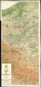
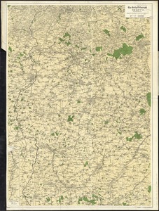
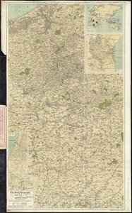
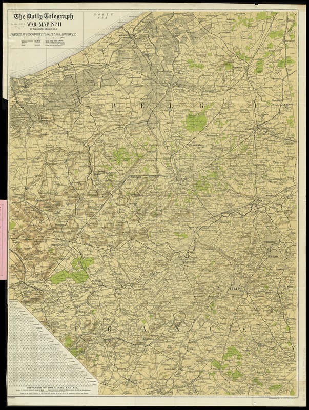
The Daily Telegraph war map no. 11
Item Information
- Title:
- The Daily Telegraph war map no. 11
- Title (alt.):
-
Daily Telegraph large scale and complete war map of the British front (no. 11)
- Title (uniform):
-
Daily telegraph (London, England)
- Creator:
- Gross, Alexander, 1879-1958
- Name on Item:
-
by Alexander Gross, F.R.G.S. ; produced by "Geographia" Ltd.
- Date:
-
[1915]
- Format:
-
Maps/Atlases
- Location:
-
Boston Public Library
Norman B. Leventhal Map Center - Collection (local):
-
Norman B. Leventhal Map Center Collection
- Subjects:
-
World War, 1914-1918--France--Maps
World War, 1914-1918--Belgium--Maps
France--Maps
Belgium--Maps
1915
- Places:
-
France
Belgium
- Extent:
- 1 map : color ; 97 x 74 cm, folded in cover 21 x 13 cm
- Terms of Use:
-
No known copyright restrictions.
No known restrictions on use.
- Publisher:
-
London :
"Geographia" Ltd.
- Scale:
-
Scale approximately 1:87,500
- Language:
-
English
- Notes:
-
Shows: international boundaries, railways, roads (2 categories), woods.
Relief shown by shading and spot heights.
Includes table for distances by road, rail and air.
- Notes (date):
-
This date is inferred.
- Identifier:
-
06_01_012050
- Call #:
-
G5701.S65 1915 .G76
- Barcode:
-
39999065692731