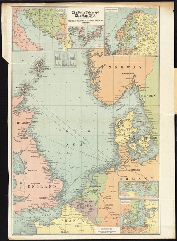
The Daily Telegraph war map no. 3
Item Information
- Title:
- The Daily Telegraph war map no. 3
- Title (alt.):
-
Daily telegraph war map no. 3 of the naval fighting areas
- Title (uniform):
-
Daily telegraph (London, England)
- Creator:
- Gross, Alexander, 1879-1958
- Name on Item:
-
by Alexander Gross ; produced by "Geographia" Ltd.
- Date:
-
[1915]
- Format:
-
Maps/Atlases
- Location:
-
Boston Public Library
Norman B. Leventhal Map Center - Collection (local):
-
Norman B. Leventhal Map Center Collection
- Subjects:
-
World War, 1914-1918--North Sea--Maps
World War, 1914-1918--Europe--Maps
Naval battles--North Sea--Maps
North Sea Region--Maps
Europe--Maps
- Places:
-
Europe
North Sea
Europe
- Extent:
- 1 map : color ; 97 x 63 cm, folded in cover 21 x 13 cm
- Terms of Use:
-
No known copyright restrictions.
No known restrictions on use.
- Publisher:
-
London :
"Geographia" Ltd.
- Scale:
-
Scale approximately 1:2,000,000
- Language:
-
English
- Table of Contents:
-
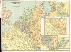
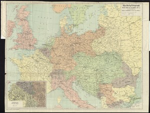
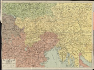
Daily Telegraph war map no. 3
The Adriatic Sea and adjacent countries
Scene of Japanese operations
North Western Europe
The Mediterranean Sea and adjacent countries
The Baltic Sea & adjacent countries.
- Notes:
-
Depths shown by soundings.
Insets: The Adriatic Sea and adjacent countries -- Scene of Japanese operations -- North Western Europe -- The Mediterranean Sea and adjacent countries -- The Baltic Sea & adjacent countries.
Includes table comparing British, French, Russian, German, Austrian-Hungarian and Italian navies.
- Notes (date):
-
This date is inferred.
- Identifier:
-
06_01_012042
- Call #:
-
G5701.S65 1915 .G76
- Barcode:
-
39999065692657